January 2024
When people who’ve been to Antarctica say the pictures don’t do it justice, well, they’re not kidding. It’s difficult to put into words and – despite all the beautiful photos we now have – even harder to capture with a camera.
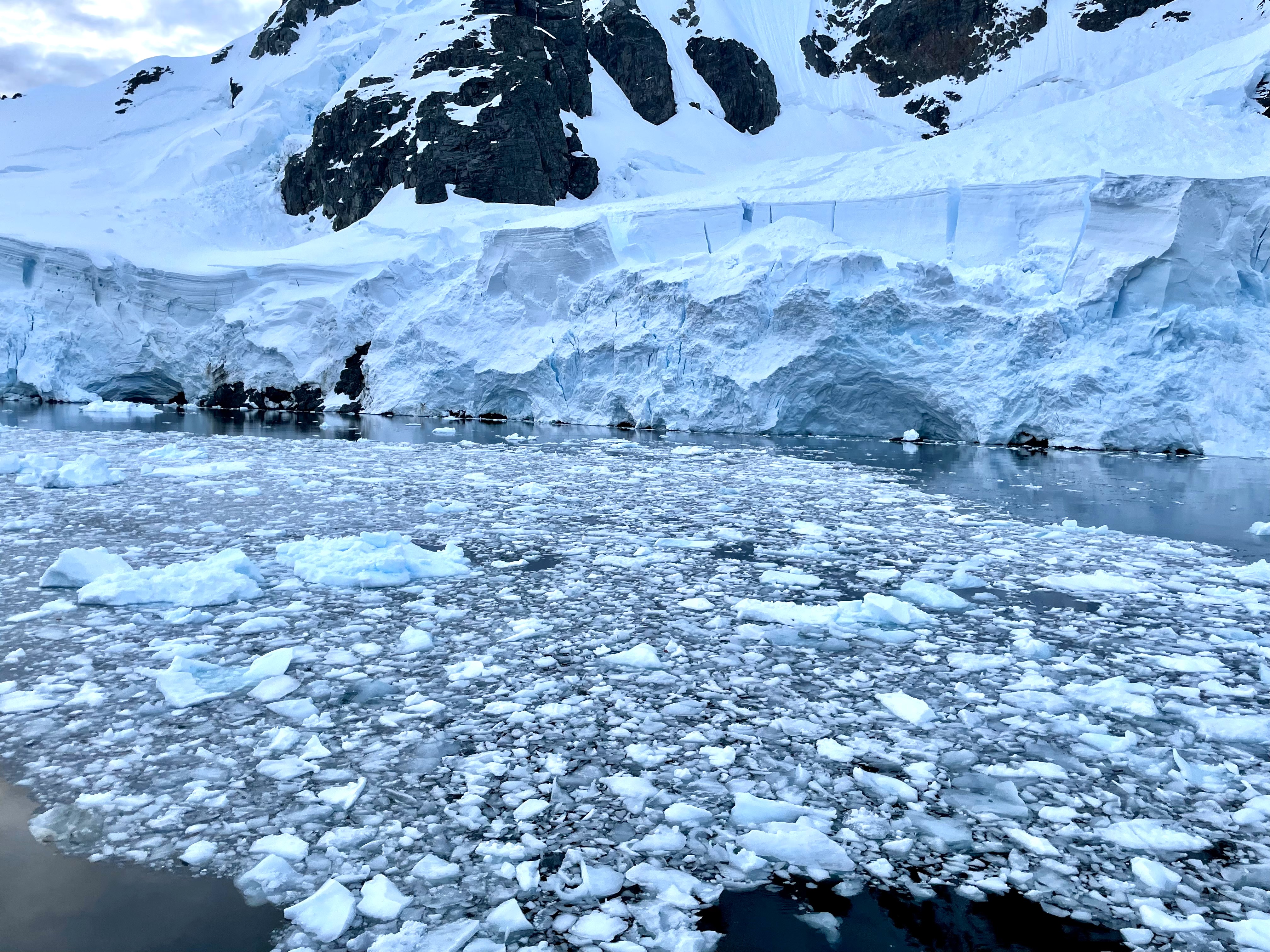
We were so lucky with the weather – which it probably goes without saying is very unpredictable, with wind as Enemy Number One. We did have a few very windy days and experienced snow, sleet, and even some rain, but by and large we lucked out with sunshine and glassy, calm waters. Because of that we not only had an opportunity to camp on the ice one night, but we also managed to take the ship farther south than it’s been able to make it in many years of voyages in the Antarctic summer – 68°14’6”S, well below the Antarctic Circle. We were up close and personal with three kinds of penguins and four kinds of seals, and saw three kinds of whales, including a large pod of orcas and a humpback whale that surprised us by coming up for a blow when it was only ~15 feet from our 10-person zodiac (😱).
We helped respond to a medical emergency at Port Lockroy, and learned a lot about the protocols for ships traveling in the region, which are obligated (and happy) to help with transportation and other assistance for people working in this remote area. We gathered data about phytoplankton, learned about krill and the formation of sea ice, recorded cloud data for NASA, and donned our bathing suits for a polar plunge in 0-degree water in the Buchanan Channel. We hiked on land and we explored in zodiacs, often pausing just to listen for a while to the bird calls and the moving ice, trying to take it all in. We visited historic sites and we learned how to protect the penguins from avian flu. We even survived a dreaded “Drake Shake” on our way back to Argentina (barely). We’re going to try not to be annoying with our constant desire to share photos and videos and stories and all the things we learned about this magical part of the earth – but if you don’t fancy an impromptu workshop on icebergs or the food web of the Antarctic peninsula, you might want to steer clear of us for awhile! 🤣❤️
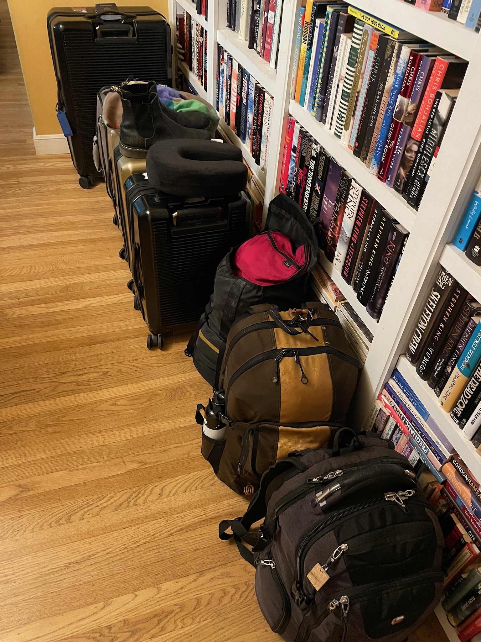
We really pride ourselves on our light packing. But not for a trip to Antarctic tundra, bookended by the 95° heat of summer in Buenos Aires. We also had to contend with strict weight limits for domestic flights within Argentina, between Buenos Aires and the southernmost tip of the country (Ushuaia, where the ship came into port), which meant more bags of lighter weight. It was a lot of bags. It was annoying and we don’t know how people travel regularly with so much luggage!
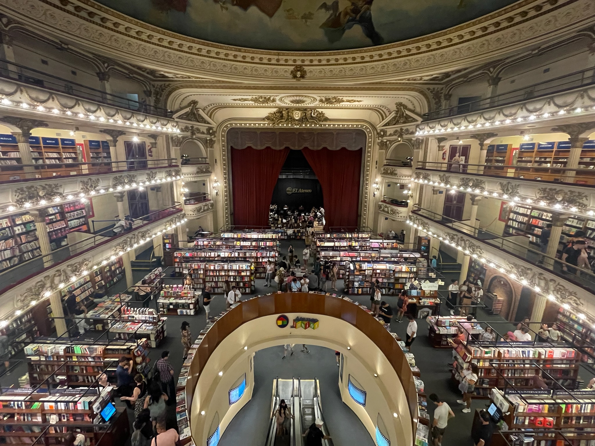
We had never been to Buenos Aires, so we built in a few extra days to explore there (also serving as a buffer in case of airline delays, since if you miss this ship there’s no way to board at a later port…there ARE no later ports). This included a visit to El Ateneo Grand Splendid, a huge and beautiful bookstore located in a former, historic theater. 🤩🤓
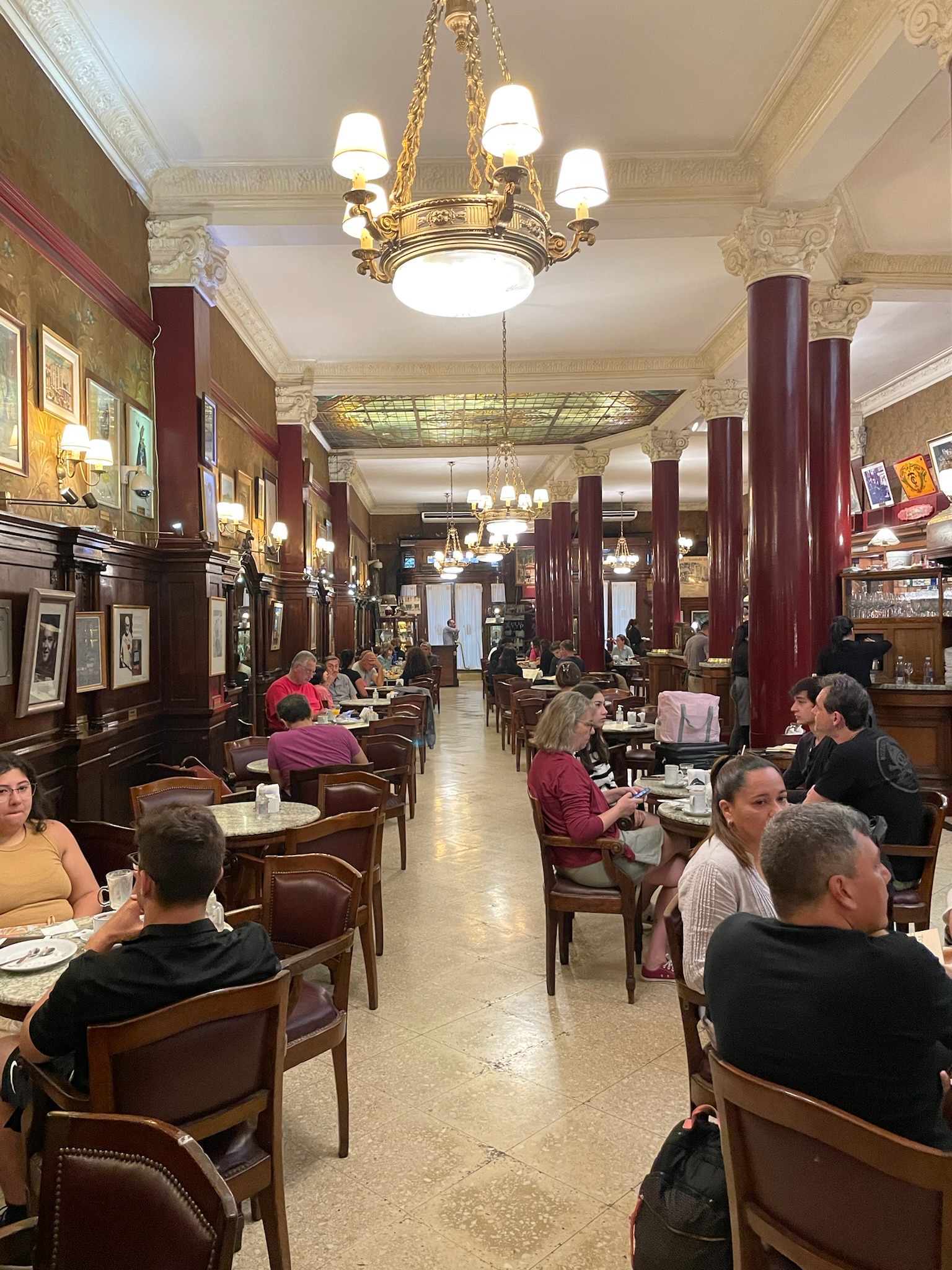
We also had to make a stop at the famous Café Tortoni, for some chocolate con churros and to absorb some of its history as a promoter and protector of art and literature over the last almost-200 years.
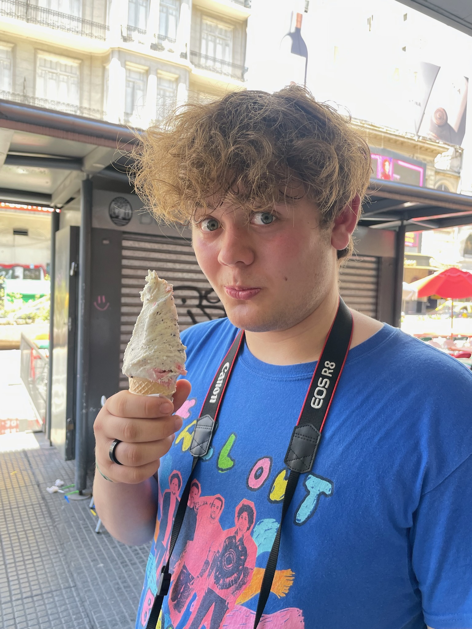
Plus we had to eat. We were told that the ice cream was not to be missed. It was indeed delicioso.
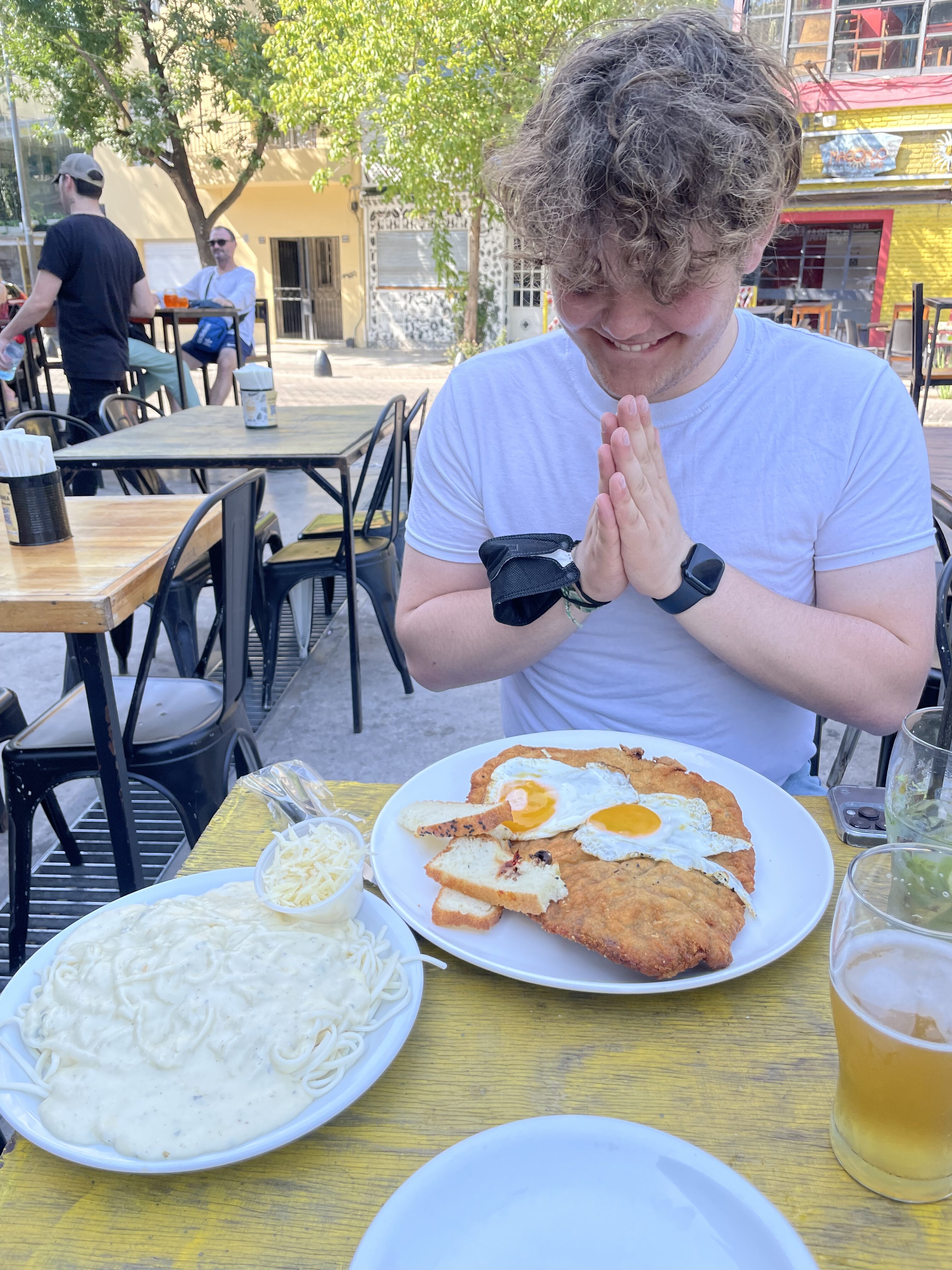
We also ate approximately our weight in milanesas. Argentinians do not mess around when it comes to food.
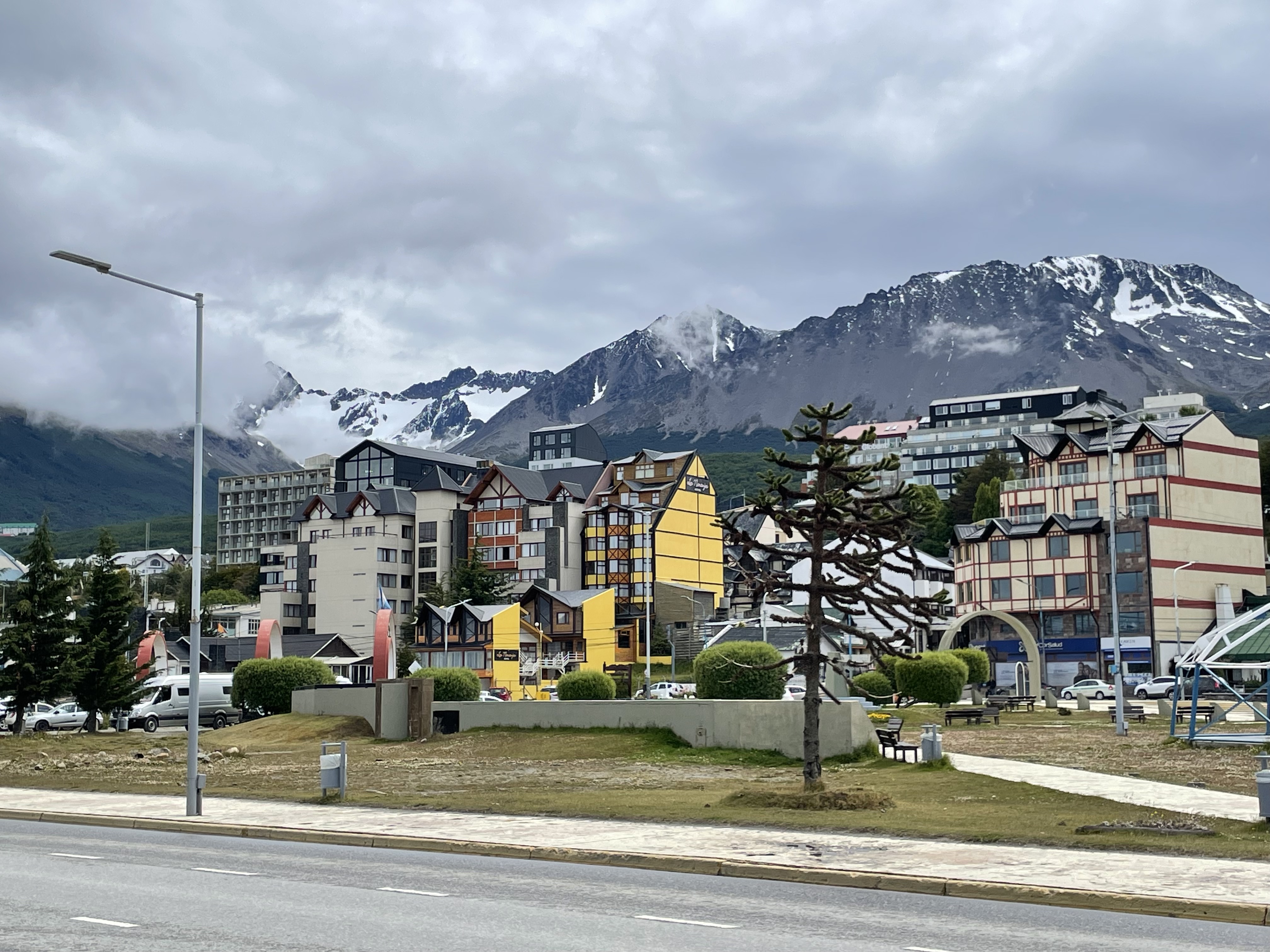
Eventually it was time to head to Ushuaia, which is very proud of being the southernmost city in the world. It used to be a sleepy little “city” at the edge of South America, but this season an Apple Store opened – we’re told it’s changed dramatically over the last decade or so, as it’s become increasingly more common for giant cruise ships to take people for sightseeing in the waters around the Antarctic Peninsula.
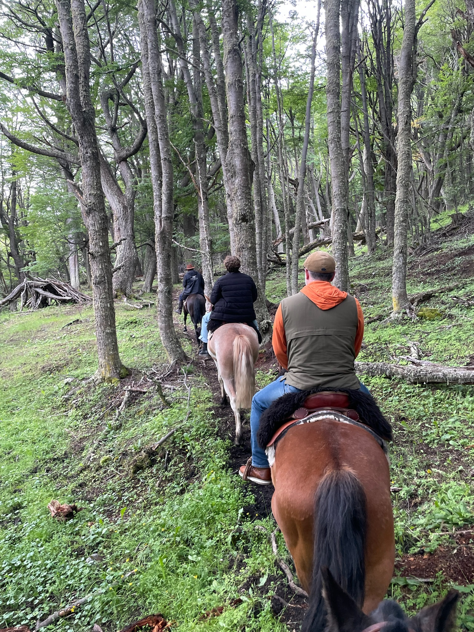
We had a required day and a half in Ushuaia for briefings and prep before we could board the ship. In our downtime we managed to squeeze in a horseback ride in the Reserva Natural Cerro Alarkén, near our hotel.
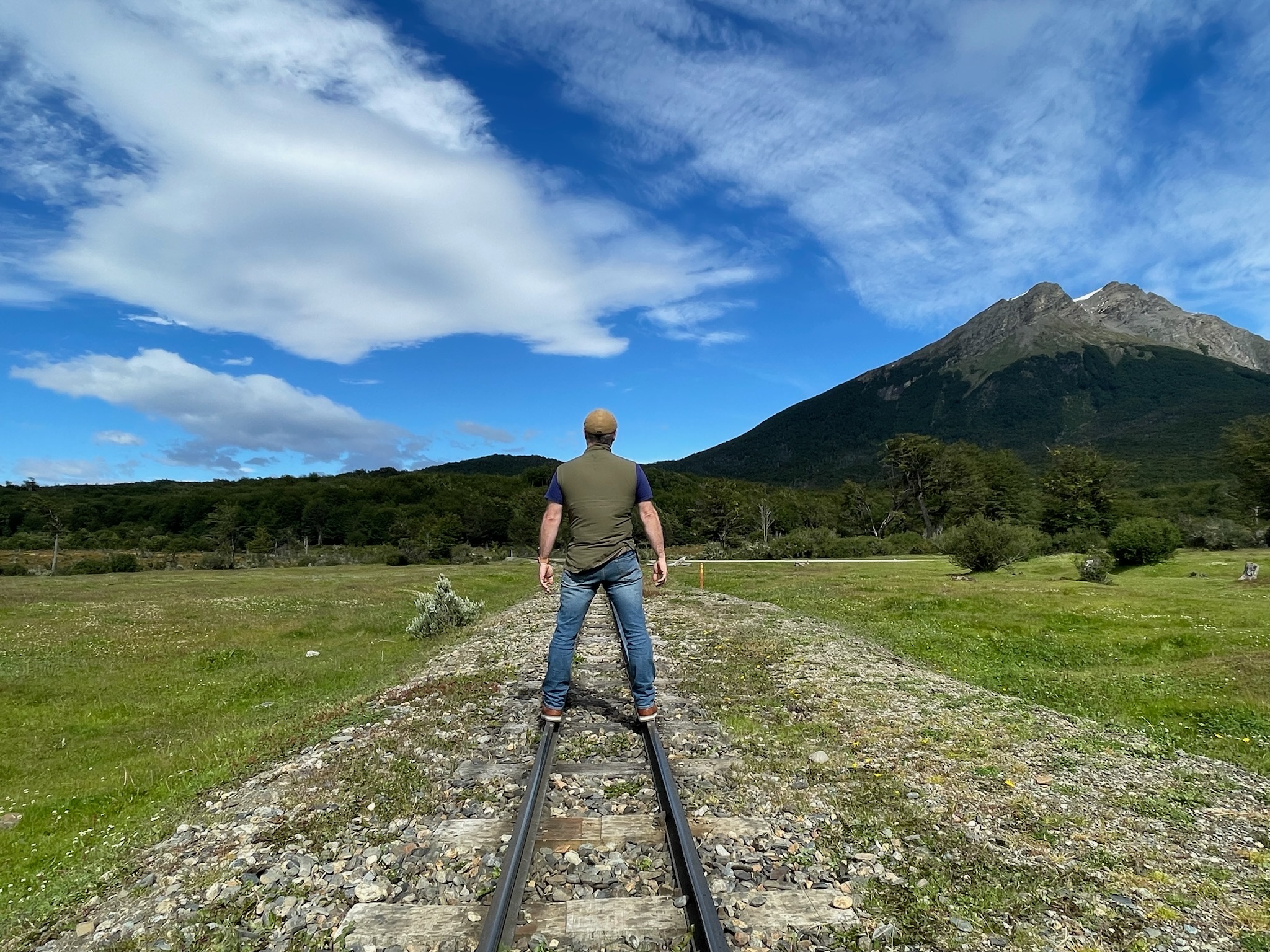
We also booked a guided tour of Terra del Fuego National Park, trekking out to the very end of the Pan-American Highway and taking the “Fin del Mundo” train ride, where we learned about Ushuaia’s dark origins as a penal colony.
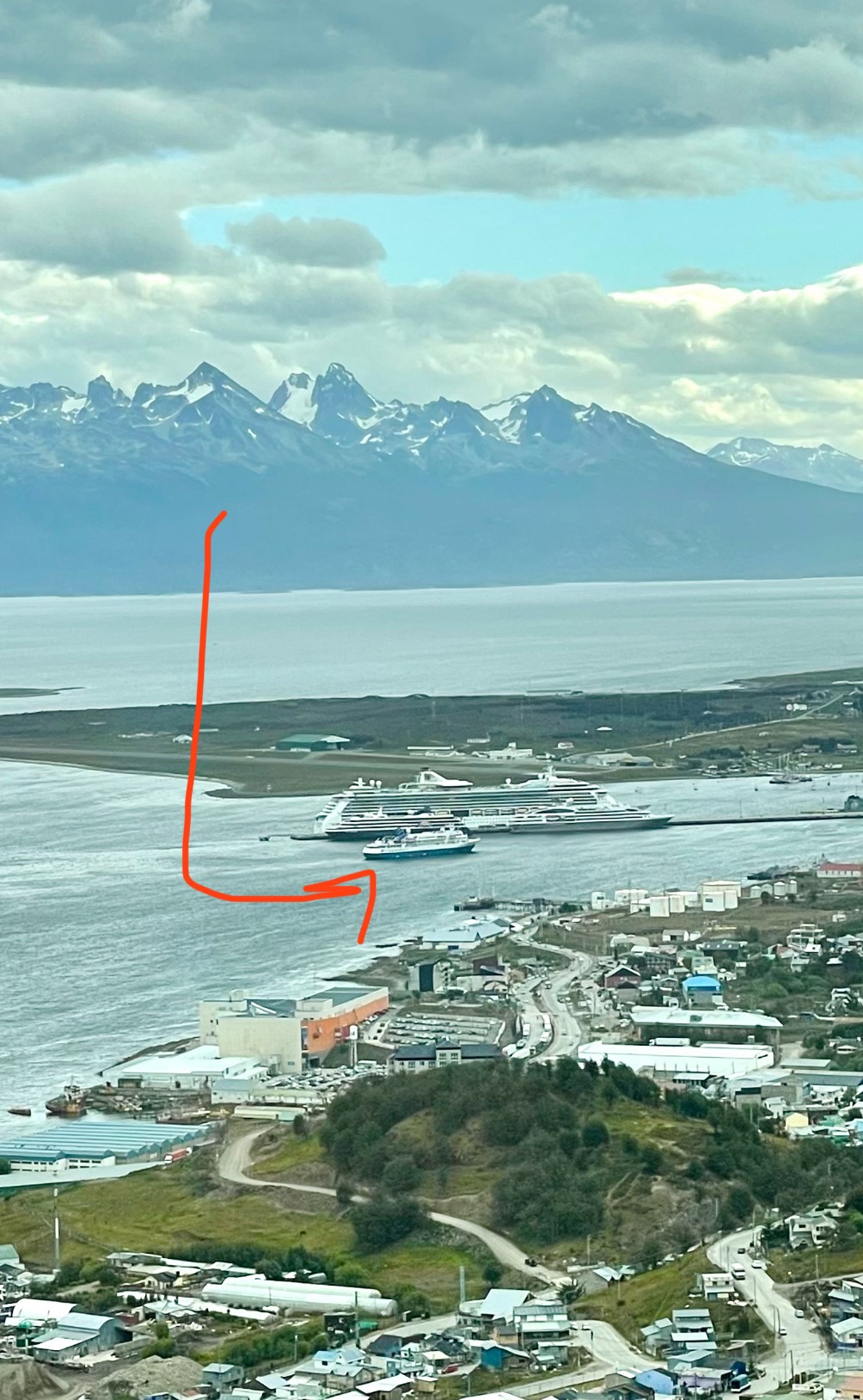
Yes, giant cruise ships go to Antarctica. But if they have more than 500 people aboard they’re never allowed to land – it’s all (remarkable) sightseeing from the decks of the ship. Below 200 people, the Antarctic Treaty allows passengers to depart the ship and explore in zodiacs, but not touch land. Landings are only permitted for groups of 100 people, so there are advantages to sailing in a small, scrappy ship. (Though there are some disadvantages too, including cost, but also the Drake Passage…stay tuned for more on that.) From our hotel we could see when our ship came into port. It’s not the giant Royal Caribbean ship or even those mid-sized ship. It’s the little bitty ship in the front. Which – except in the Drake Passage – was pretty awesome.
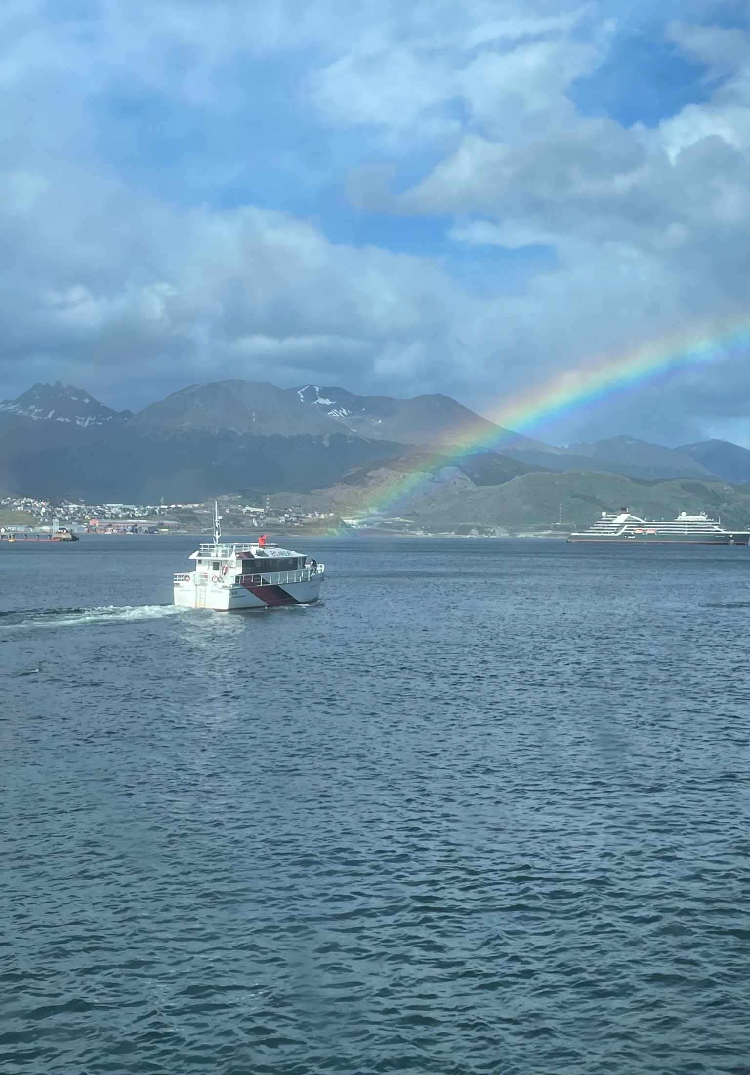
If you know our family well, you know that it was a tumultuous time for us to get here – we started booking this trip in 2017 for a 40th birthday trip in 2020…and between now and then it was cancelled and rescheduled four times (only twice for COVID). Until we had left the port it was hard to believe it was really going to happen, and the whole adventure wasn’t suddenly going to be called off for some catastrophic reason. But just before we set sail there was suddenly a beautiful rainbow out our cabin window…we took that as a sign that all the trials and tribulations were going to have been worth it.
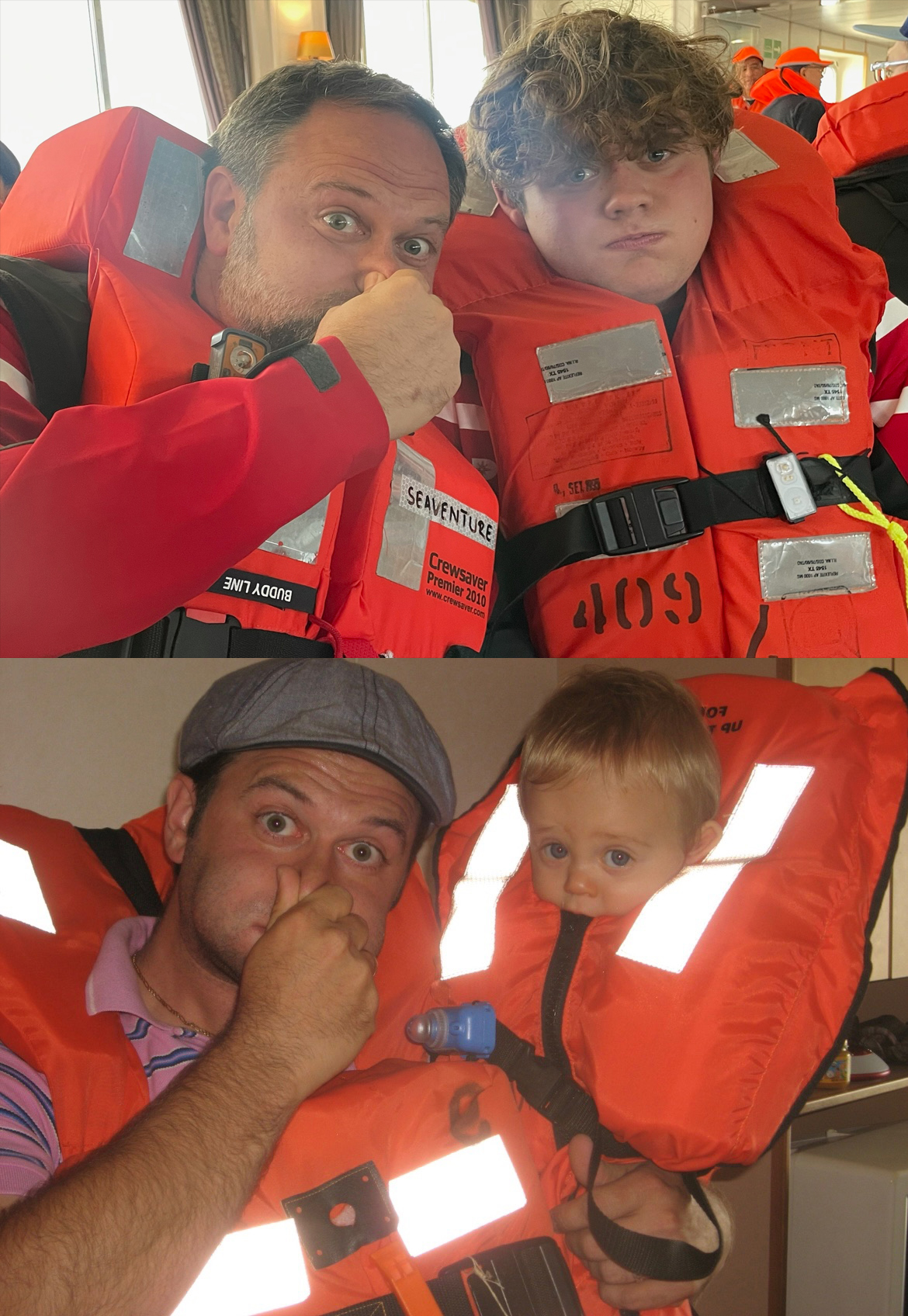
If you’ve ever been on a cruise, you know that before they can leave shore, all passengers have to attend a “muster drill” and practice donning their life jackets and reporting to their assigned lifeboat stations. We had a lot of fun recreating (top) this photo of Cole during his first-ever muster drill, when his grandparents invited him (and his parents) on a Mediterranean cruise with them.
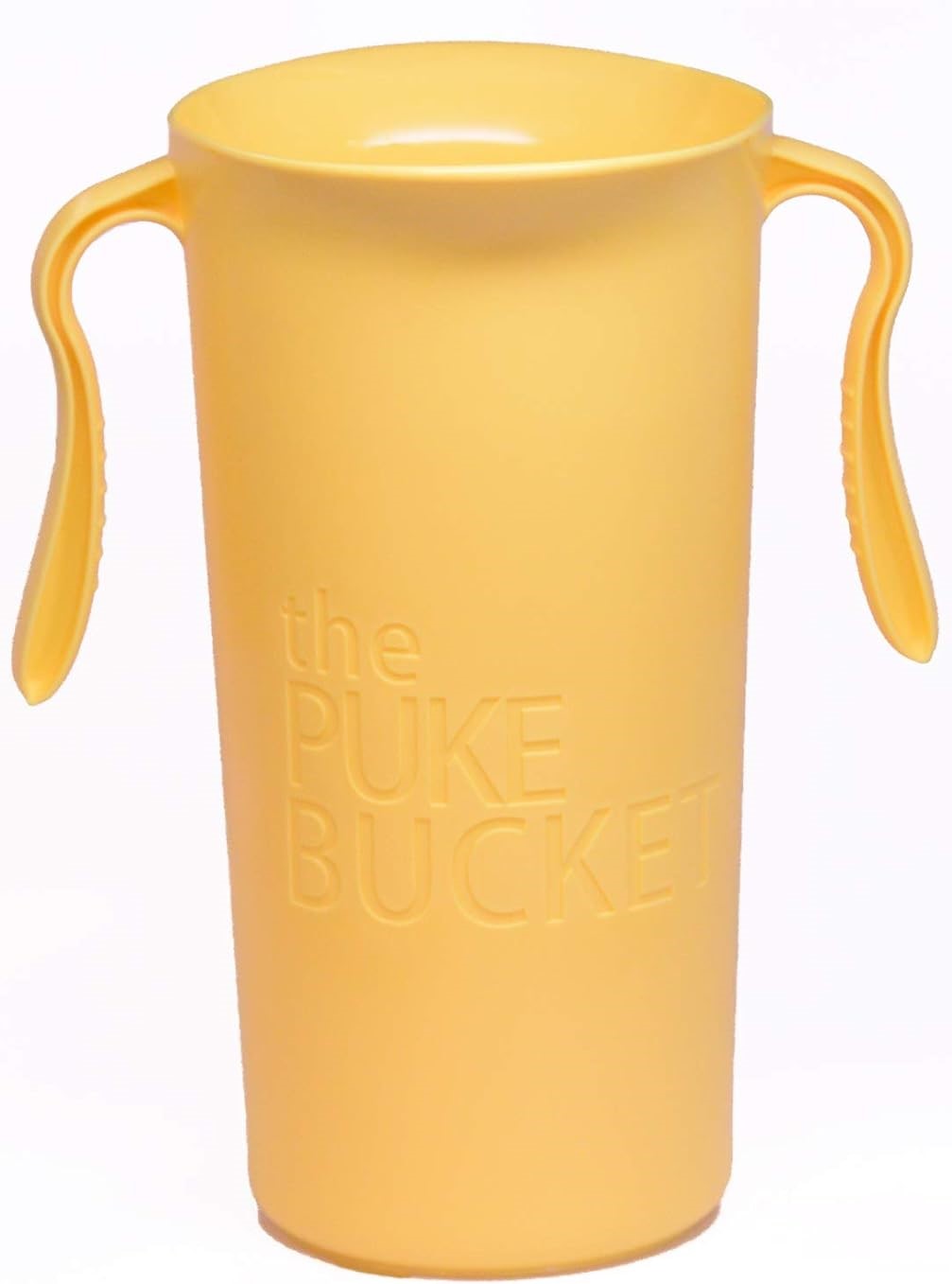
OK, the Drake Passage. This is the name for the infamous stretch of water between the tip of South America and the tip of the Antarctic Peninsula. It’s where the Atlantic and Pacific Oceans meet, but more importantly it’s also where the very rapidly moving waters of the Southern Ocean – which is the only ocean able to speed around the globe unimpeded by land masses – gets squeezed into a choke point. There are a LOT of sunken ships in the Drake Passage, luckily almost all from hundreds of years ago. Unless you’re going by plane (which is extremely rare), spending the better part of two days traversing this 620-mile stretch of turbulent water is just something you have to do. Informally people tend to rate the travel experience as somewhere on a continuum of “Drake Lake” to “Drake Shake,” depending on the size of the swells and the wind speeds (which are directly proportional to the amount of vomiting on board). We thought it was bad on the way down. We didn’t take photos, so you’ll have to just imagine it while you look at this stock photo of our Puke Bucket, which a wise friend recommended just 3 days before we left (thank you Amazon Prime). But once we came out the other side we were dismayed to hear the crew laughing about how it was “not quite Drake Lake but definitely below-average.” 🤢 During our return leg there was a storm with gale-force winds and ocean swells consistently between 12-18 feet. We didn’t leave our cabin for 36 hours. No eating or drinking. Just sitting up made me vomit. There was so much vomit. That’s also when we found out that one of the features of a “Drake Shake” (let’s check THAT one off the bucket list, shall we?) is that sometimes the ship’s propellers actually lift all the way out of the water, which causes the entire ship to intensely vibrate….since (in case you were confused) that is not supposed to happen. Cole asked me if the Drake Shake experience was worse than childbirth, and I had to think long and hard about it. I’m still not sure of the answer, and I didn’t have any pain meds in childbirth.
But no matter the workout our poor little Puke Bucket got, it was WORTH IT. Because THIS was on the other side!!!
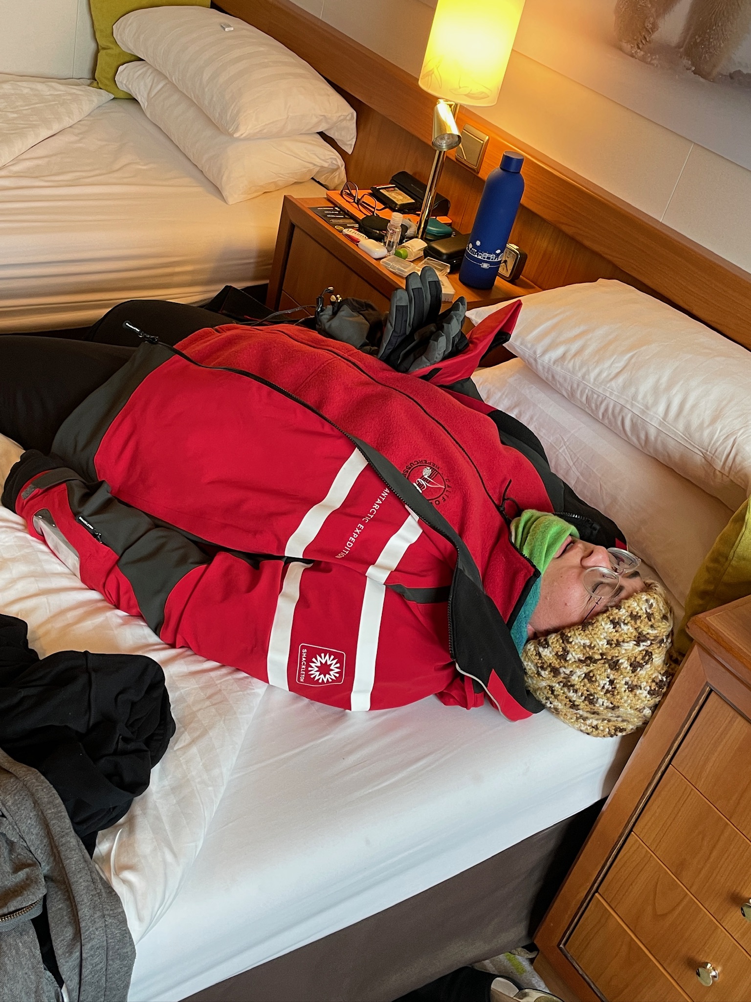
Due to the “calm water” (🤨) in the Drake on the way down, we made record time and were all surprised to arrive in Fournier Bay the night before it was planned, which meant we were able to go out on a zodiac cruise the evening before our first full day in Antarctica. This was our first time getting all suited up and ready for the cold. We weren’t sure how long it would take to get ready to go, so we rushed and then spent a bunch of time overheating in the cabin waiting for the announcement that our zodiac was ready. 🥵
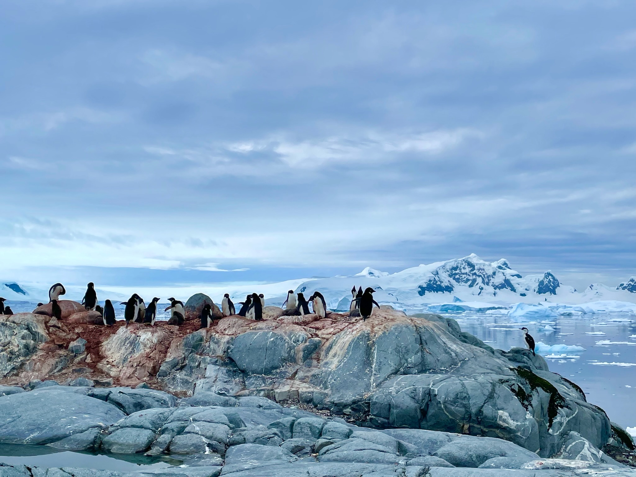
Our zodiacs had a driver and 8-10 people on them. There really is no way to describe what it was like to be out among all that ice and animals like this.
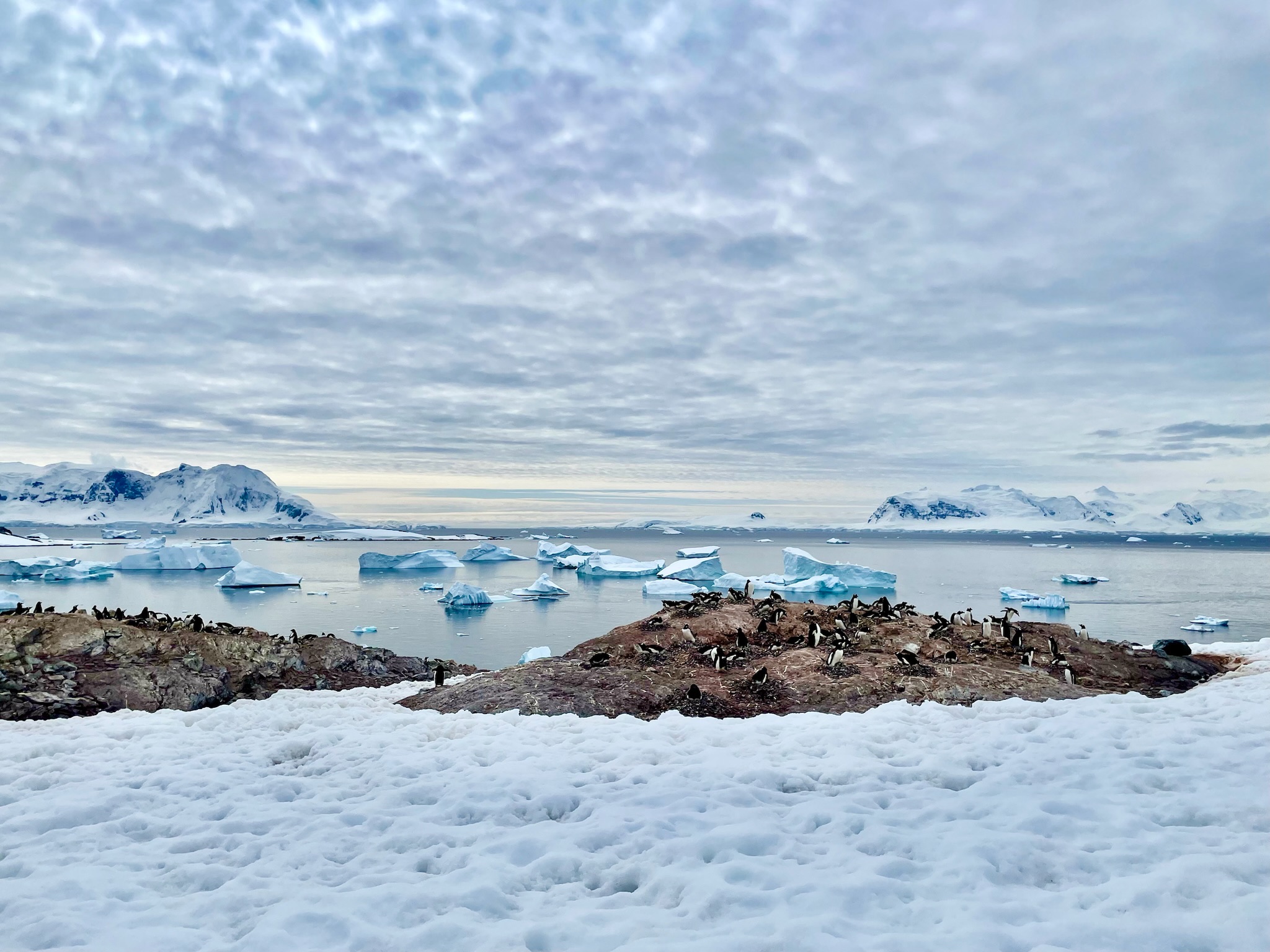
Our second day we were able to do a landing at Cuverville Island. It’s a huge gentoo penguin colony, and there were so many chicks! And so much noise. And guano. Penguins are incredibly adorable but also incredibly loud and smelly creatures.
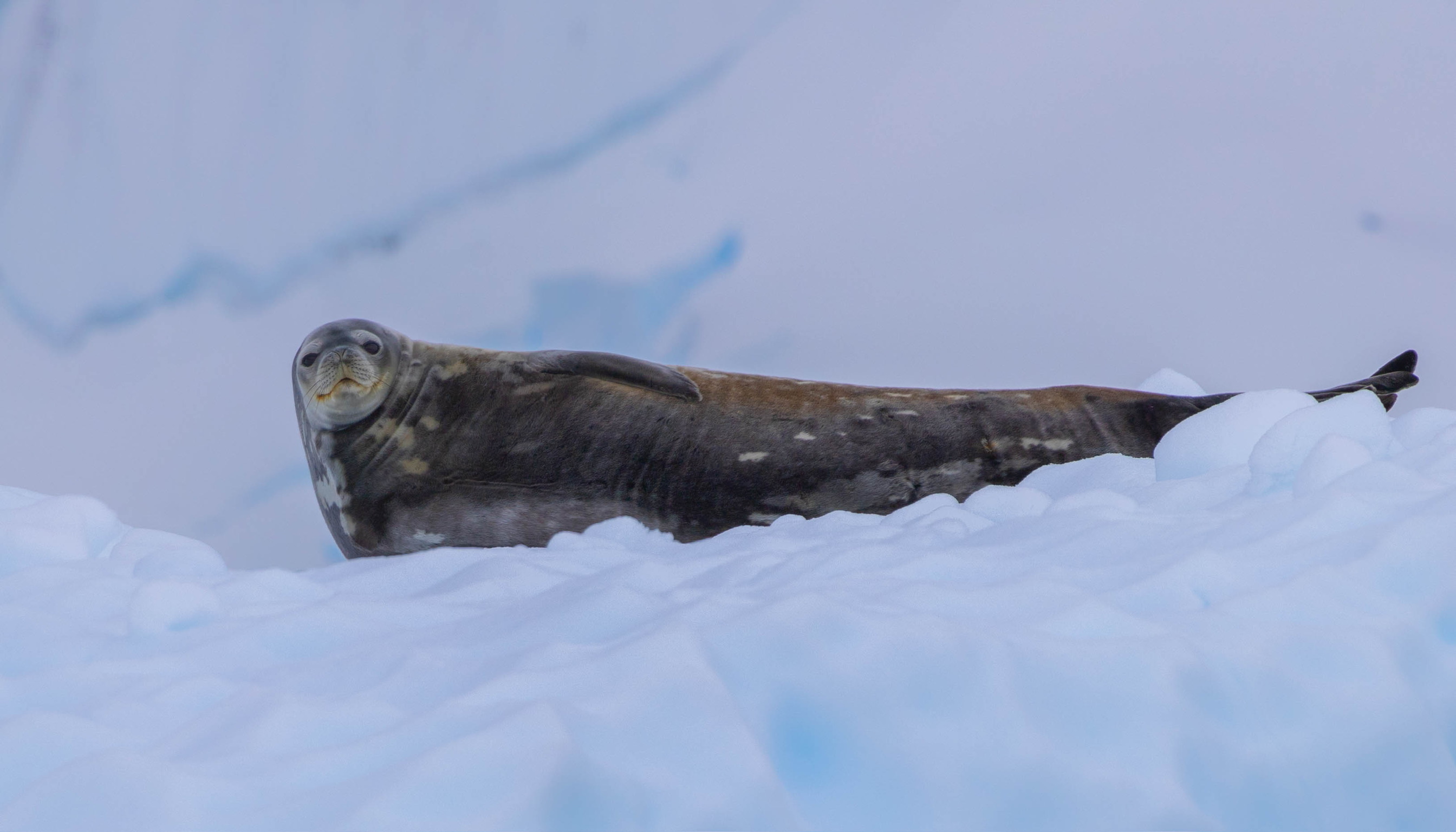
Cole is in a photography class at school and this was a great opportunity for him to practice everything he was learning. Many of these photos are his, by the way. Including of this Weddell Seal.
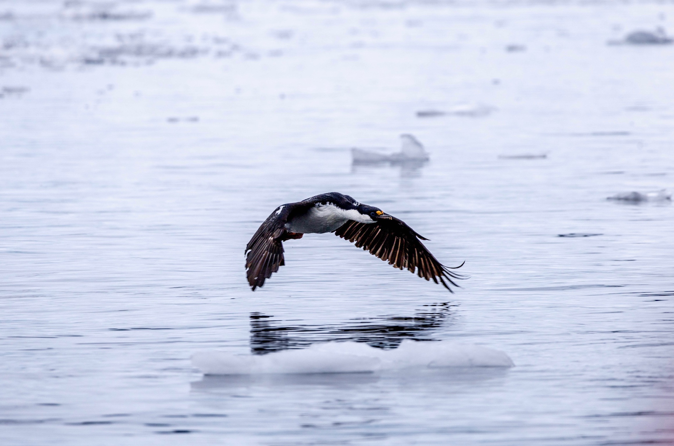
Cole also took this photo of a Blue-Eyed Shag. We aren’t really birders (unlike a lot of the people on our ship) but there were so many gorgeous birds, including shags, Antarctic terns, kelp gulls, and both snow and storm petrels.
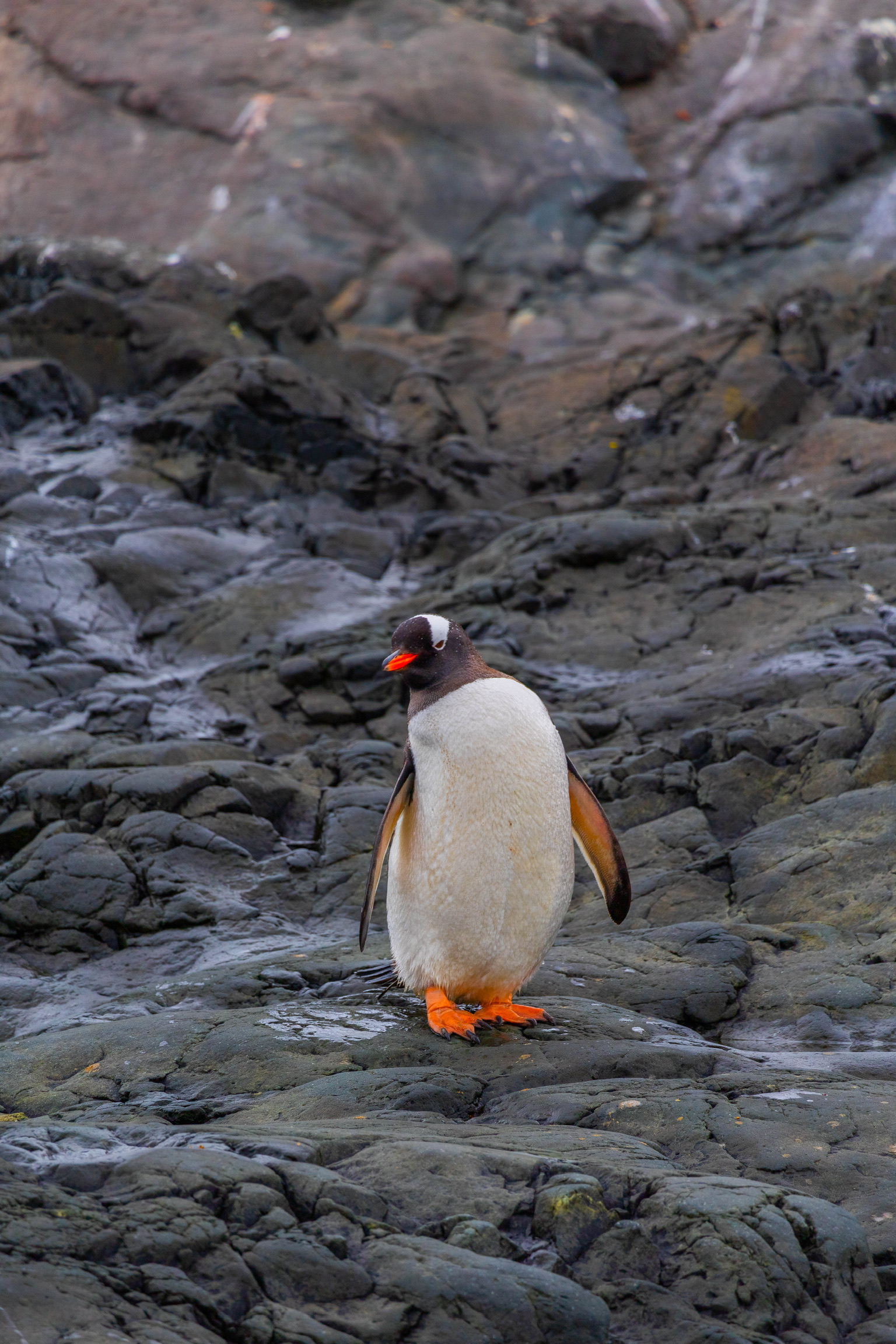
Did we mention that penguins are freaking adorable? (This is a Gentoo.)
It’s really hard to pick a favorite spot we went (of 12 landings/zodiac adventures), but Cuverville Island is easily in the top 3. Those icebergs in the bay? That sky? Those penguins? Come on.
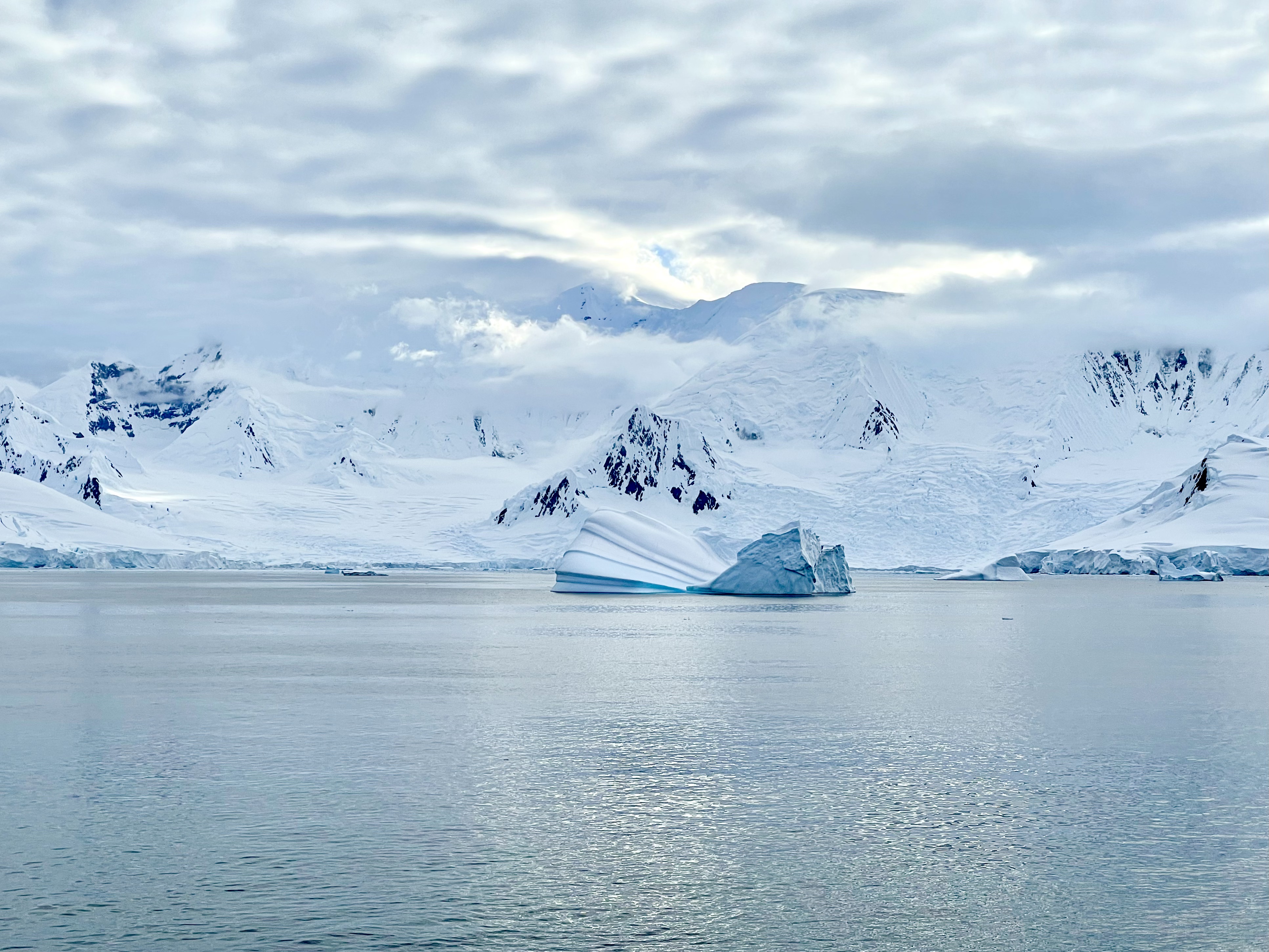
Every time we passed a giant iceberg it was hard not to think about the Titanic and then remind ourselves that ships have amazing technology in the 21st century and we were totally safe. But still, this is a weird sight to see outside your cabin window.
One of the main reasons we picked Polar Latitudes for our Antarctic adventure was their commitment to Citizen Science on board! The ship was outfitted with a science lab and we gathered lots of data and learned a lot about the environment we were exploring. This was the day we went out on the citizen science zodiac in Paradise Bay, and collected data for the FjordPhyto program (https://fjordphyto.ucsd.edu/).
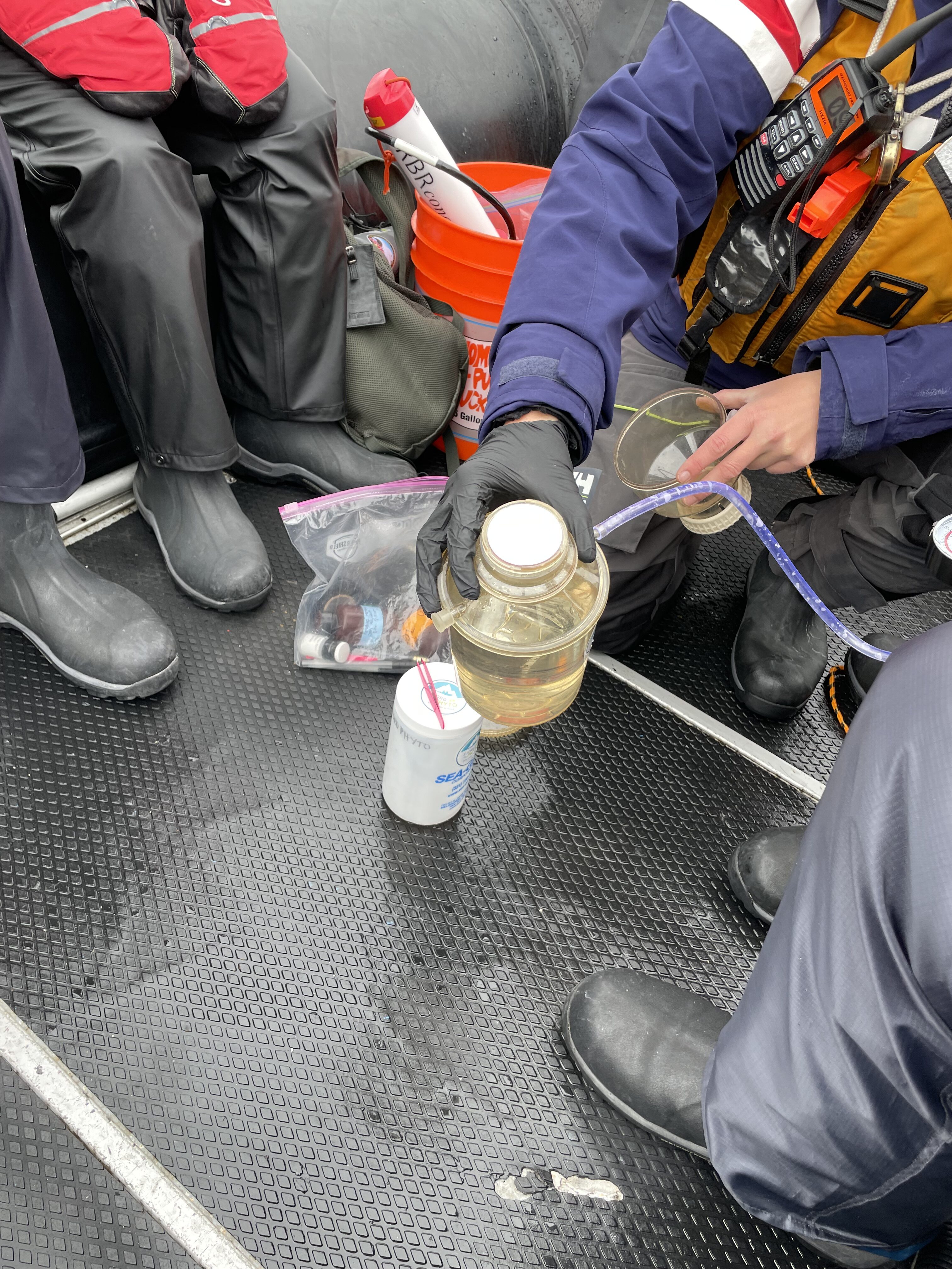
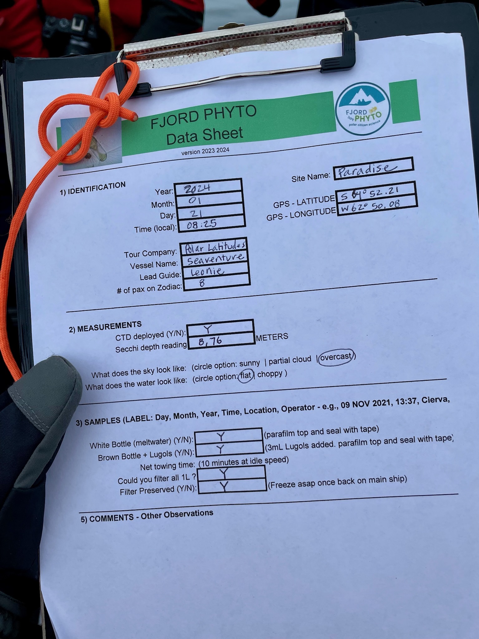
In addition to towing the phytoplankton collection unit for 10 minutes and then putting it through a vacuum filter, we also deployed a Secchi disc and lowered a “CTD”, which measures Conductivity, Temperature, and Depth of the water at our specified coordinates. All these measurements help the researchers at Scripps better understand how melting glaciers in Antarctica affect phytoplankton populations – which matters a lot, since among other things, phytoplankton is the food source for krill, which is a main food source for many whale, seal, and penguin species in the region.
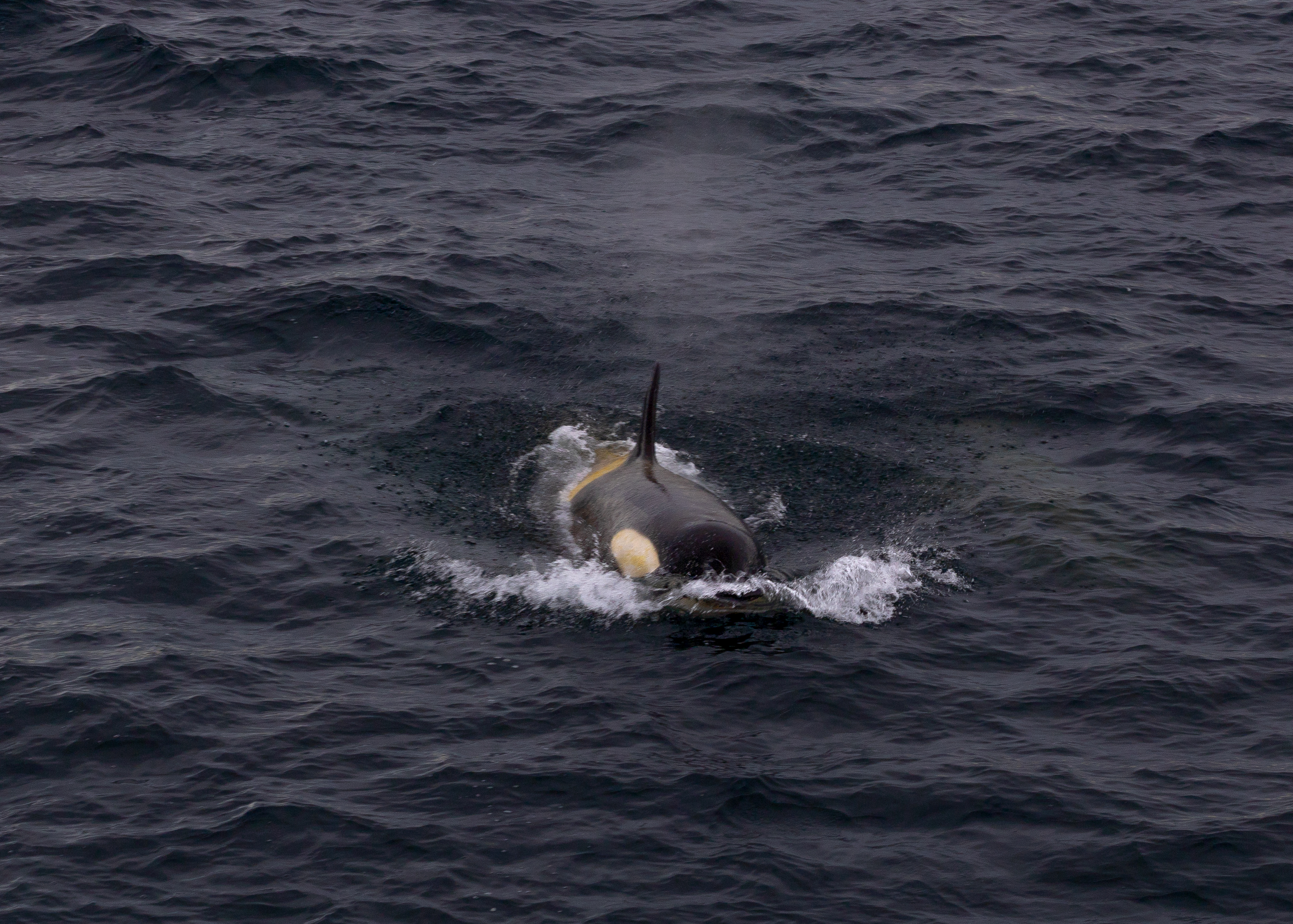
Did I mention we also saw orcas? Yes, Cole’s camera has a great zoom lens. But you didn’t need a zoom lens to see these majestic animals blowing and diving right off the bow of the ship. Luckily we had a very patient captain, who was willing to slow and even turn around the ship when there were great wildlife sightings like this one.
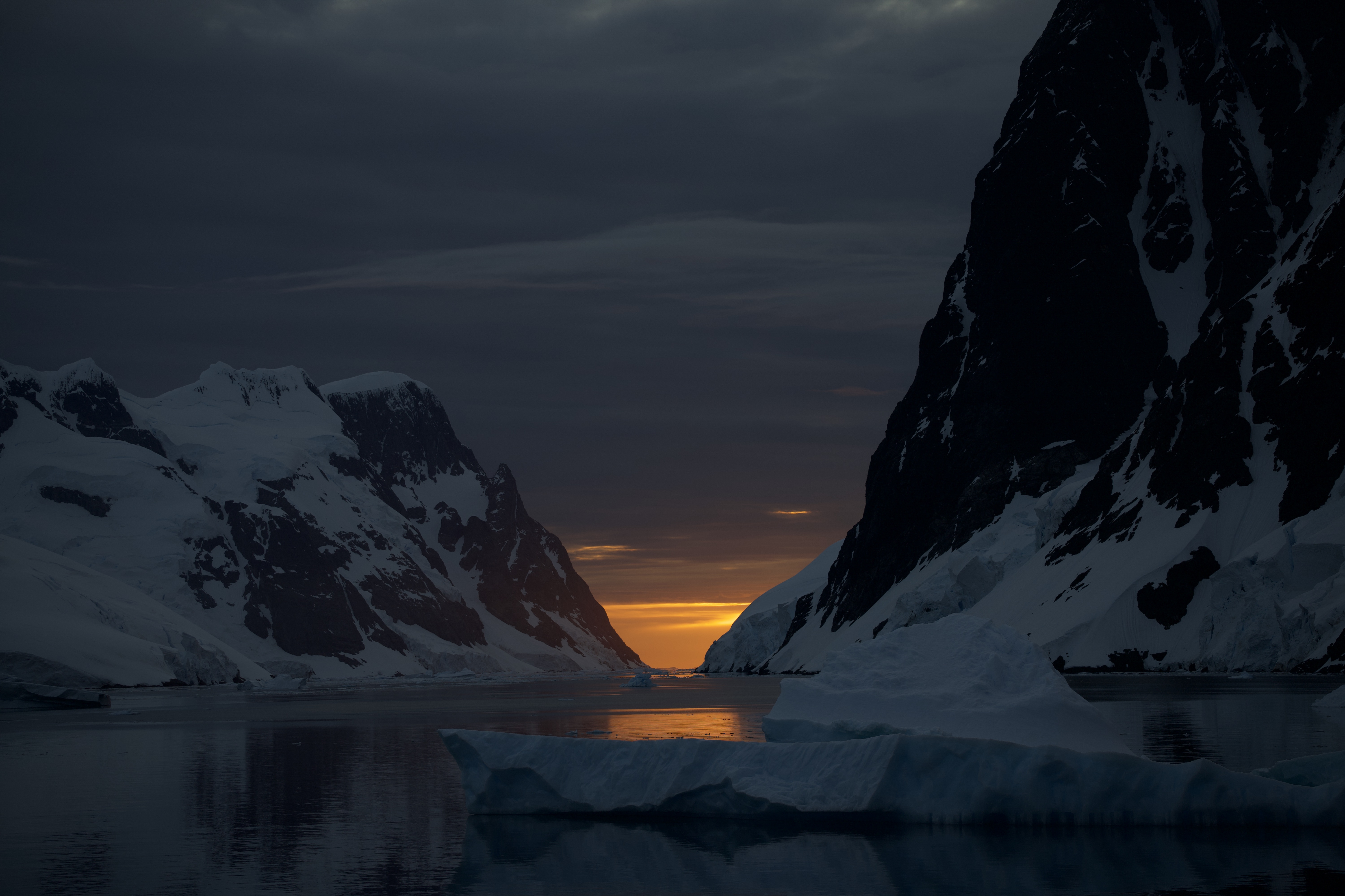
Perhaps the best thing about our great orca adventure was that it delayed us just enough that when we finally got to the Lemaire Channel in Antarctica (also known as Kodak Bay for perhaps obvious reasons?) the sun was setting, perfectly aligned in the gap. *Everyone* on the ship was either crammed onto the bow of the ship or another deck with a good view, or actually steering the ship with a great view from the Bridge. The crew – many of whom have spent months or even years of their lives sailing around the Antarctic Peninsula – was giddy about our fortune. Typically the sea ice is too substantial to sail the Lemaire Channel safely, even in the summer (in fact, we couldn’t sail through it again on our way back north and had to go all the way around Anvers Island in rough seas, instead). The fact that we were able to pass through it AND that we managed to time it perfectly for a setting sun alignment that only occurs for a few brief moments 3 or 4 times a year? Absolutely magic.
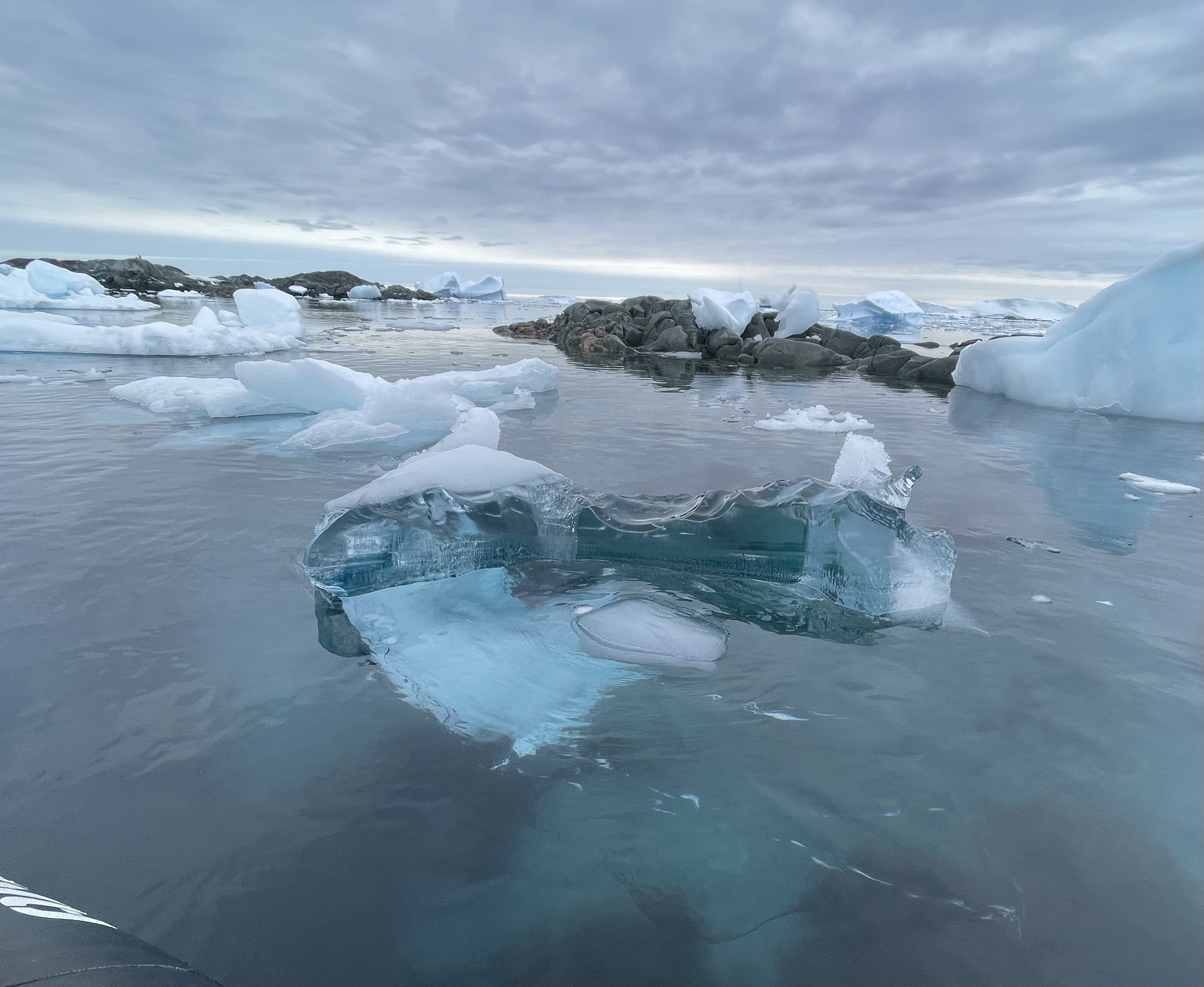
After the Lemaire channel we went to the Fish Islands and Prospect Point. In the zodiac on the way to the Fish Islands, we came across a giant piece of what’s called “black ice” – it looks pretty blue in this photo, but unlike most of the other more opaque growlers and “bergy bits” as the other pieces of iceberg in this picture are known (officially, we did not make this up) – black ice appears literally black to the naked eye because it is super, super clear and let you see straight through to the water itself, with very little light reflected back. Black ice is highly compressed ice from glaciers and is usually more than a thousand years old (sometimes thousands, plural). As ice is deposited on top of a glacier the layers underneath are compressed, and when this happens over hundreds or thousands of years, it can eventually be so compressed it’s basically pure and clear (think of diamonds). Finding a large piece of black ice like this that has separated from the glacier and is just floating along is fairly rare and definitely awe-inspiring.
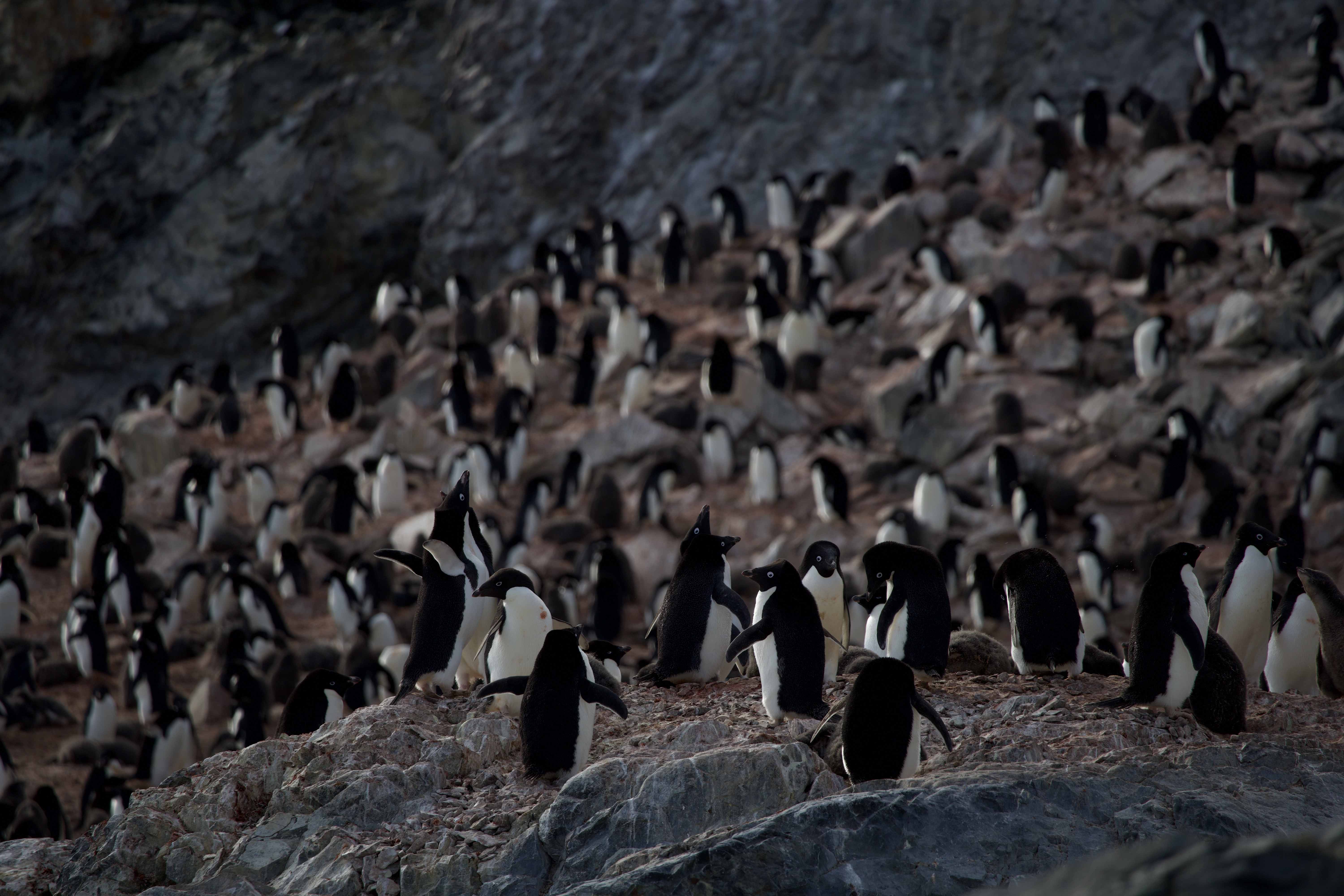
In the Fish Islands we were able to visit a rookery of Adélie penguins, or what Cole calls the “googly-eye penguins.” 👀
After our zodiac cruising around the Fish Islands we landed at Prospect Point – not an island but part of the main Antarctic Continent. Once we had our feet on the continent @Brian and I decided it was time to officially claim “7 Continent” status! It only took us 43/44 years, but we did it! Our feet on all 7 continents in the world.
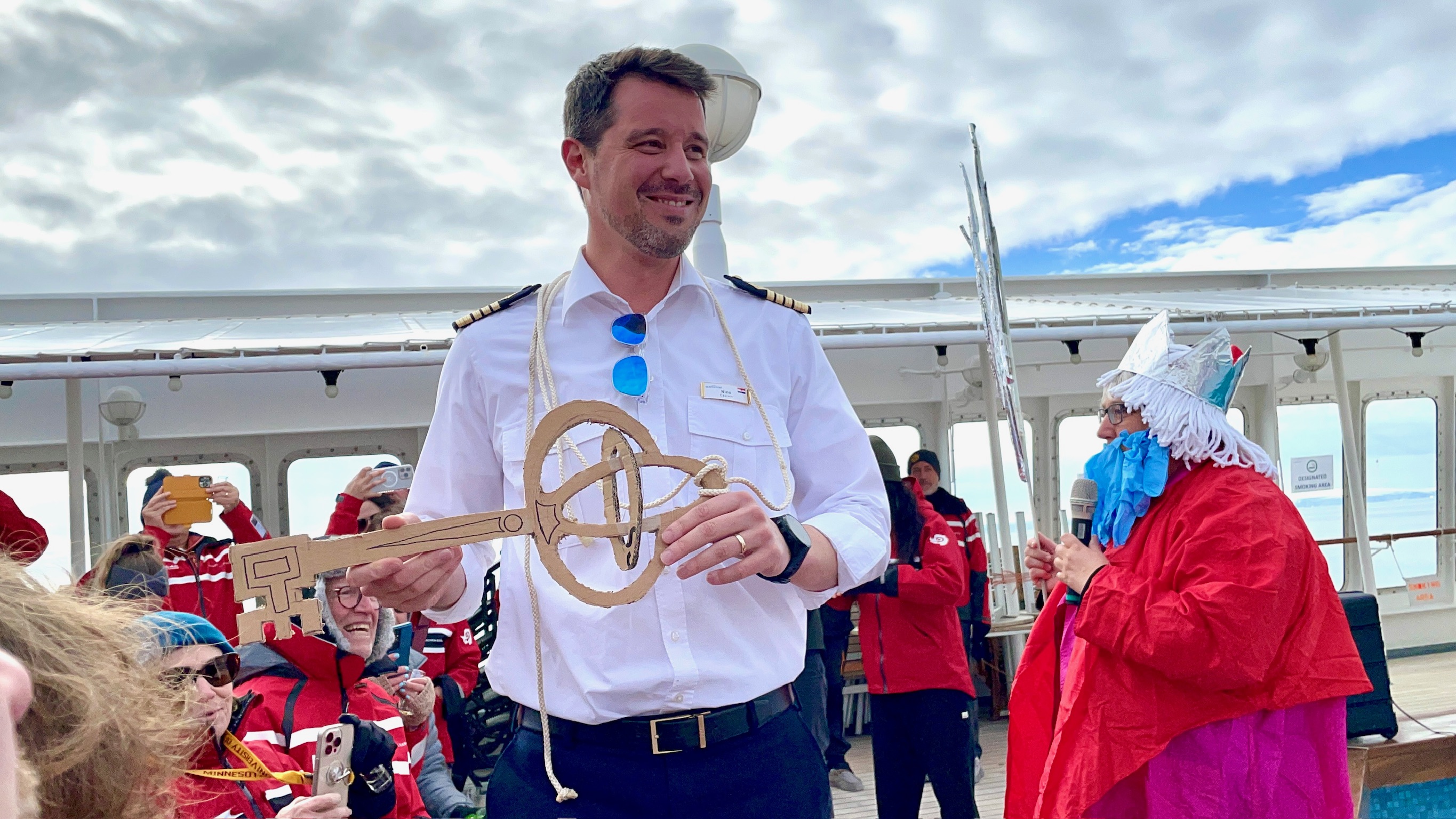
After Prospect Point we set sail south again, in the hopes of crossing the Antarctic Circle (not typical for Antarctic cruises, since it’s actually quite far south in the peninsula). We were reminded often that it may or may not happen, since sea ice and weather conditions often prevent ships from being able to cross the line – but on January 22nd we suddenly heard the a voice over the ship’s loudspeaker, requiring our presence on Deck 7 aft for “determination of our worthiness.” When we arrived there were ceremonial drinks prepared…
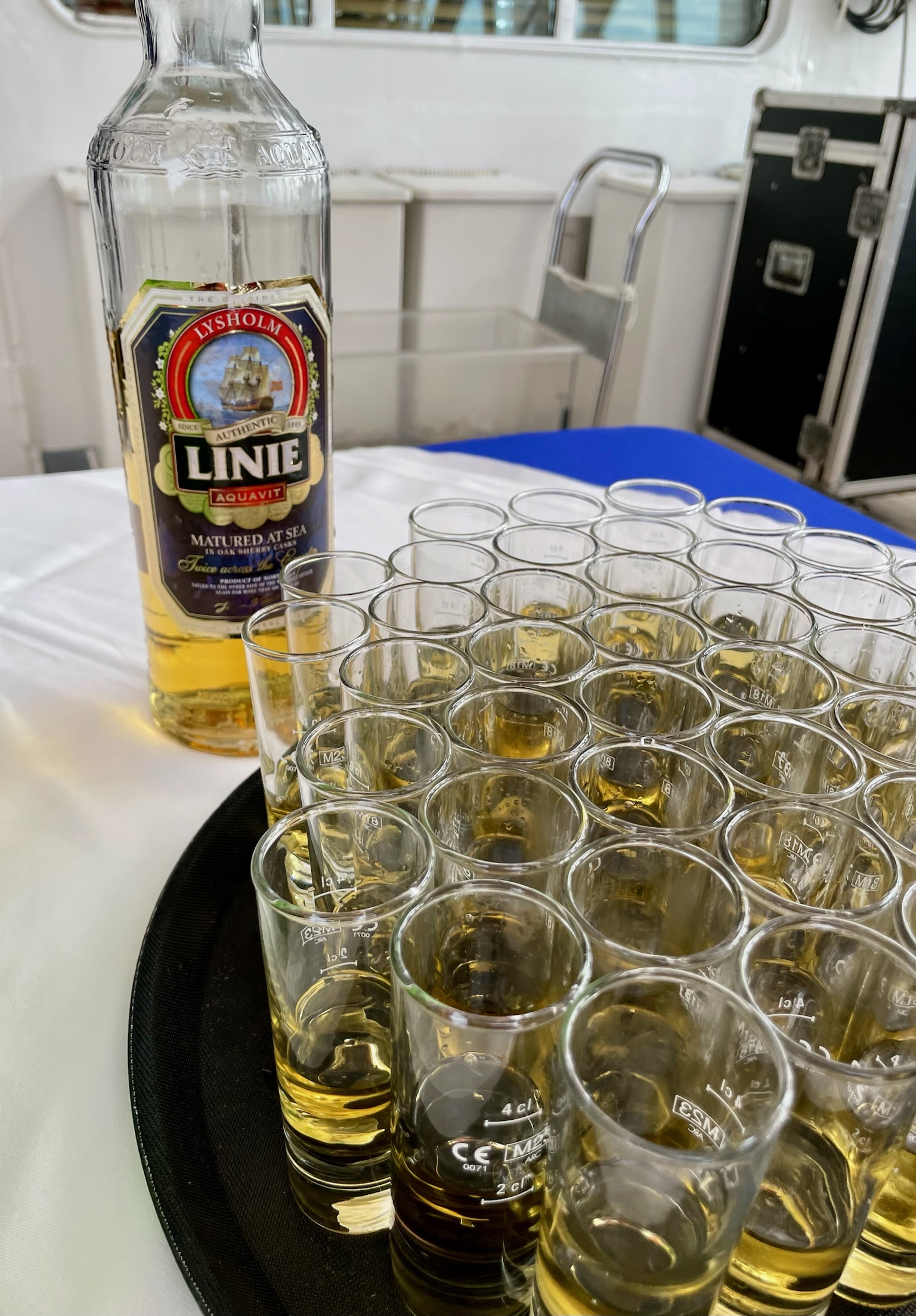
It’s a longstanding Naval tradition that the first time sailors cross one of the three major circles (the Equator and the Arctic or Antarctic Circles) there is an elaborate and often silly ceremony to induct them into the club, more or less. We were visited by King Neptune (our Exhibition Leader Hannah Larsen, wearing a mop on her head and a beard of latex gloves). She presented a key to our ship’s captain – who had never before crossed the Circle himself! – and then we all were asked to kiss a fish (no photo, sorry…it was cold and dead) and toast with Aquavit or some abnormally green non-alcoholic alternative. There was a lot of laughter and merriment and celebration. It was awesome.
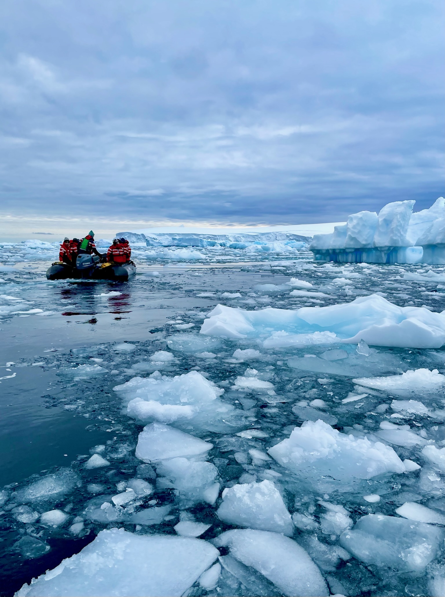
Shortly after crossing the Circle we came upon some serious sea ice – supposedly this was pack ice, which means it isn’t yet attached to the land (which is “fast ice” but instead is free-floating – but it was expansive and packed with wildlife. Fun fact: Antarctica roughly doubles in size in the winter, because there’s so much sea ice that forms all around the continent, extending into the Southern Ocean. Basically everything we visited on our trip is entirely unreachable during >7 months of the year. But mostly the point of this video is so you can giggle at the way crabeater seals (and probably all seals?) move when they’re on land. Like blubbery slinkies.
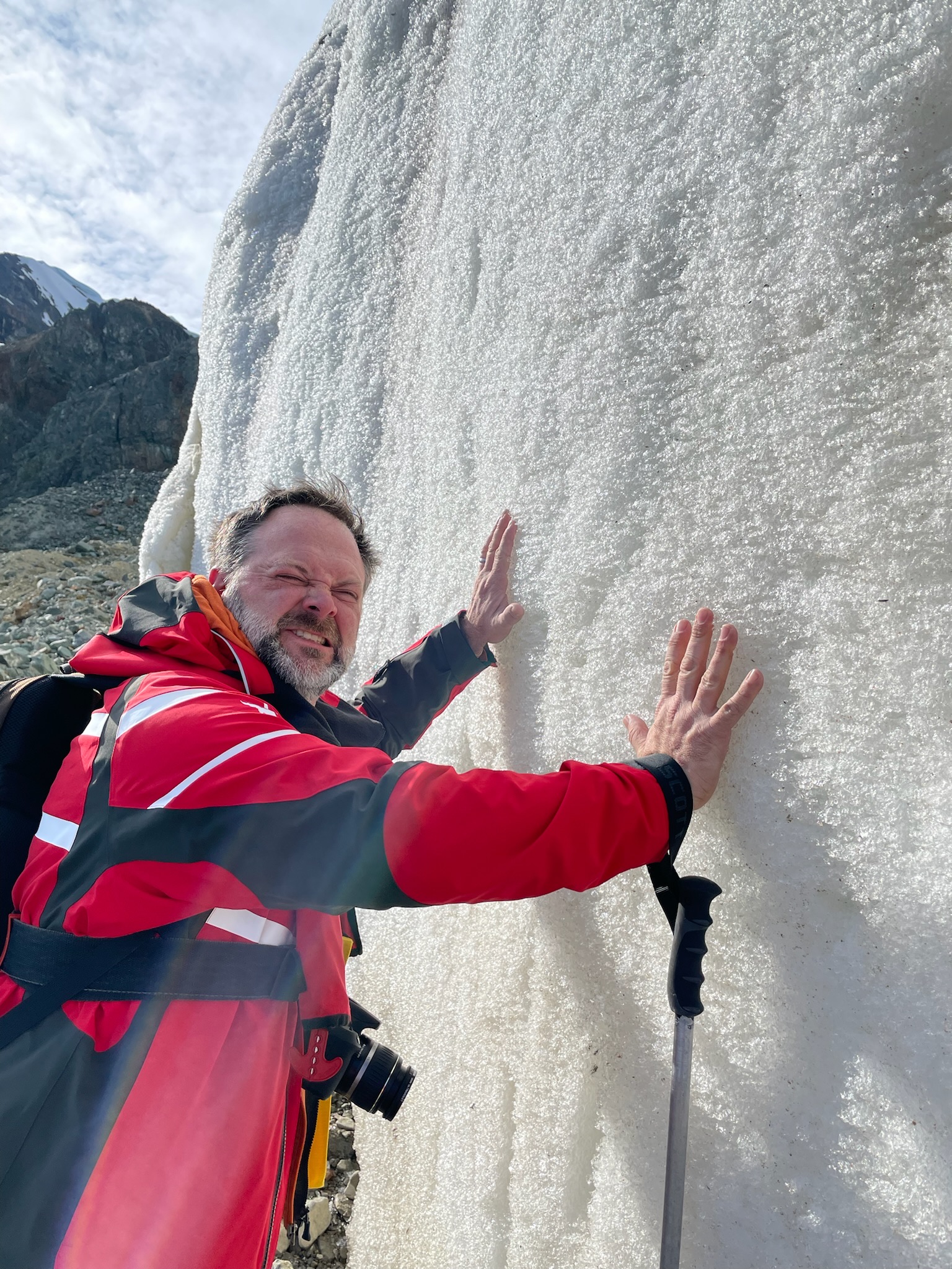
Our first stop below the Circle was Pourquoi Pas island, where we saw our first Fur Seal (sorry no photo) and more importantly got to hike to a glacier and actually put our hands on it. It was an exhausting hike. We asked for the name of the glacier and after some research were told it didn’t really have a name, because there are so many in Antarctica most don’t actually have names, beyond maybe something like G-1462. So there you have it. Still cool. You’ll be in our memories forever, G-1462.
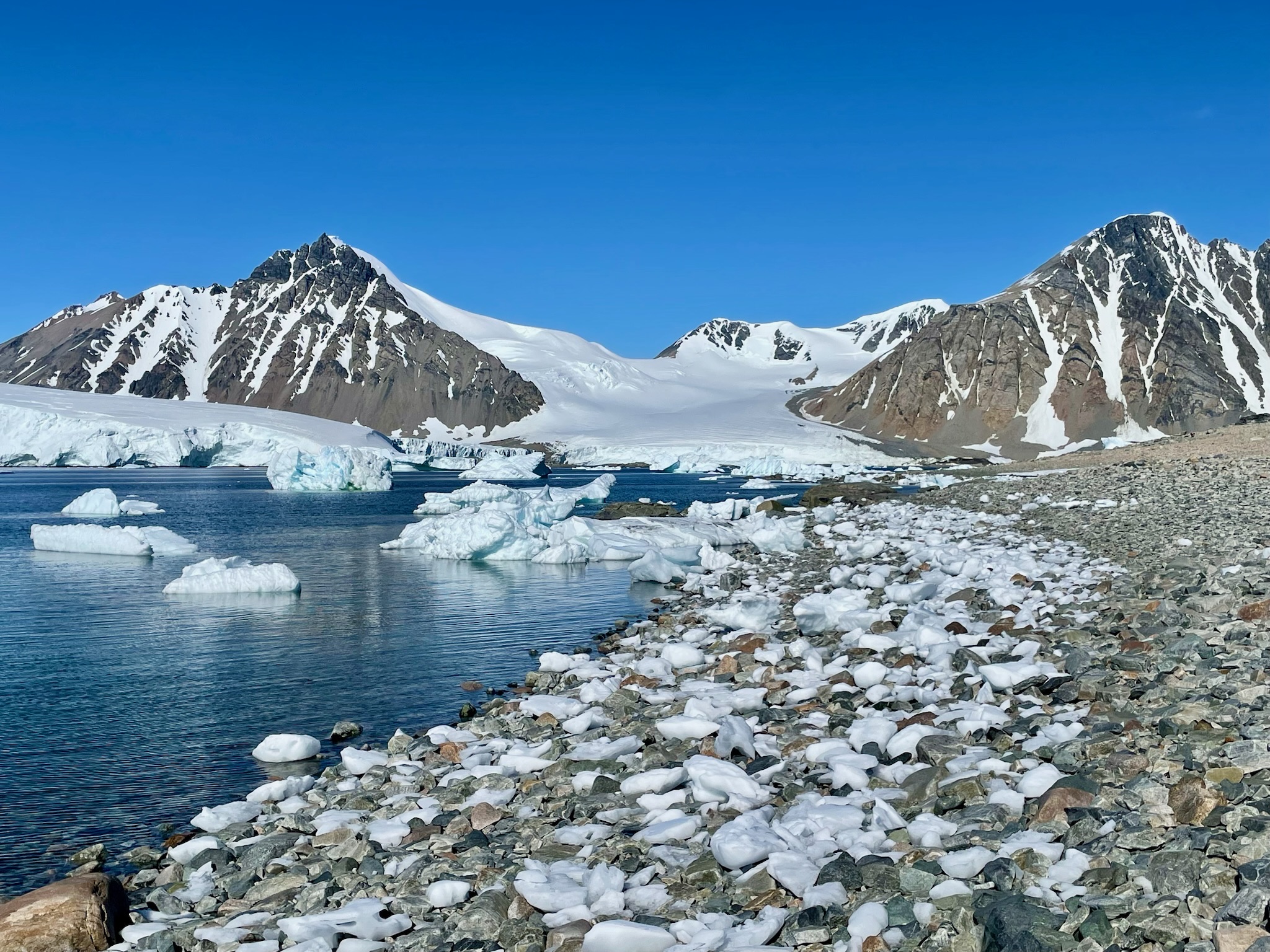
Our southernmost excursion on the trip was to Stonington Island. This was some sort of bizarre, serendipitous alignment of the universe, since as many of you know Brian and I grew up in towns adjacent to Stonington, CT. In fact, Stonington Island was named after Stonington, CT, since that’s the home port of the sloop from which Nathanial Palmer first sighted the Antarctic continent in 1820. Those of you from CT might know that the Palmer House is a museum for this same explorer, who incidentally is also the namesake of Palmer Station, an active U.S. Research Station on Anvers Island that we also saw on our trip. It was an absolutely glorious day and we had a few hours to hike around the island and explore. Amazing.
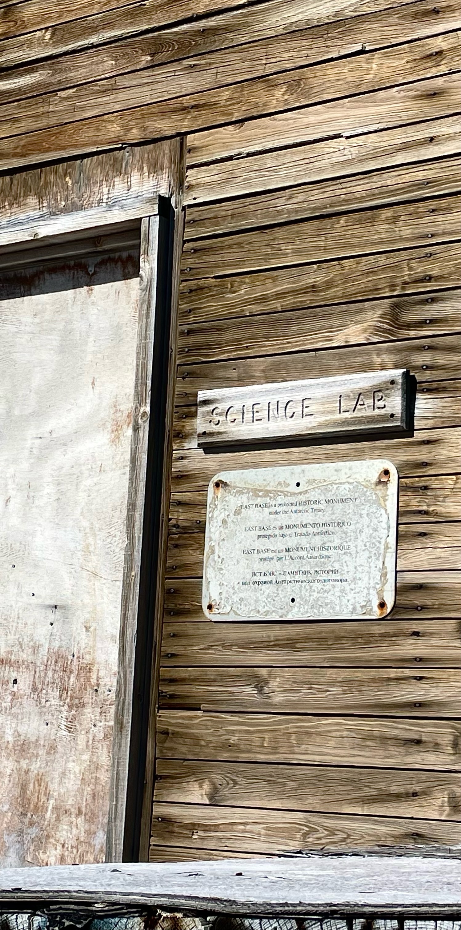
Stonington Island is also very cool because it’s the site of the historic East Base, the U.S. research hut where Jackie Ronne and Jennie Darlington made history as the first two women to ever winter over in Antarctica, in 1947-48. We were able to go inside the hut and see the historic artifacts, which was quite special.
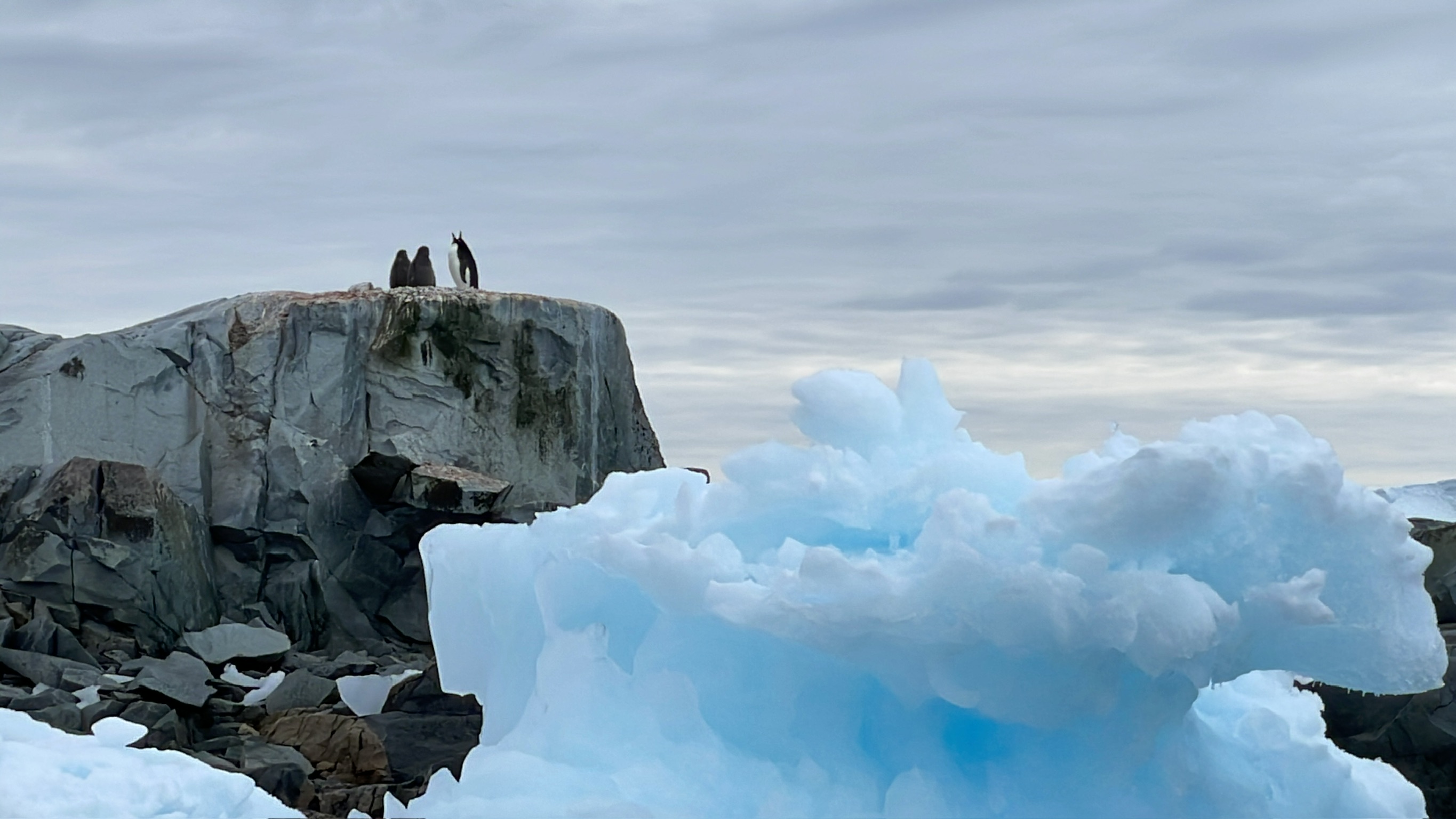
This is just a photo of an iceberg and some penguins. Because it’s a cool photo. And because maybe there haven’t been quite enough photos of icebergs and penguins yet?
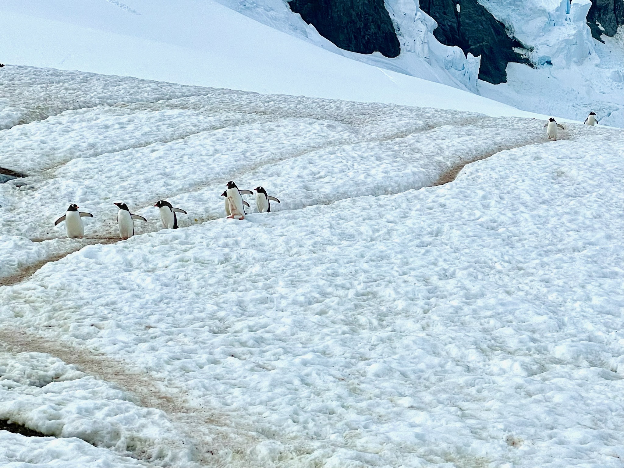
Speaking of penguins, if you don’t already know that they create and then travel in “penguin highways,” this is information you definitely need in your life. It is seriously one of the most adorable things ever to watch these lines of clumsy silly penguins slipping and sliding and waddling their way through the snow like this.
Shortly after Stonington Island we needed to begin heading north again. Our next stop was Port Charcot, and this was where we got our first real dose of proper Antarctic weather. The sun was still out for the most part but while we were hiking the wind picked up something fierce – the Bridge reported about 40 knots, which per the Beaufort Wind Scale is about the time that minor structural damage starts to happen. They hurried us back to the zodiacs pretty quickly because it isn’t really safe for land lubbers to be out and about in those kind of winds. (Sound on for this video to get the full effect!)
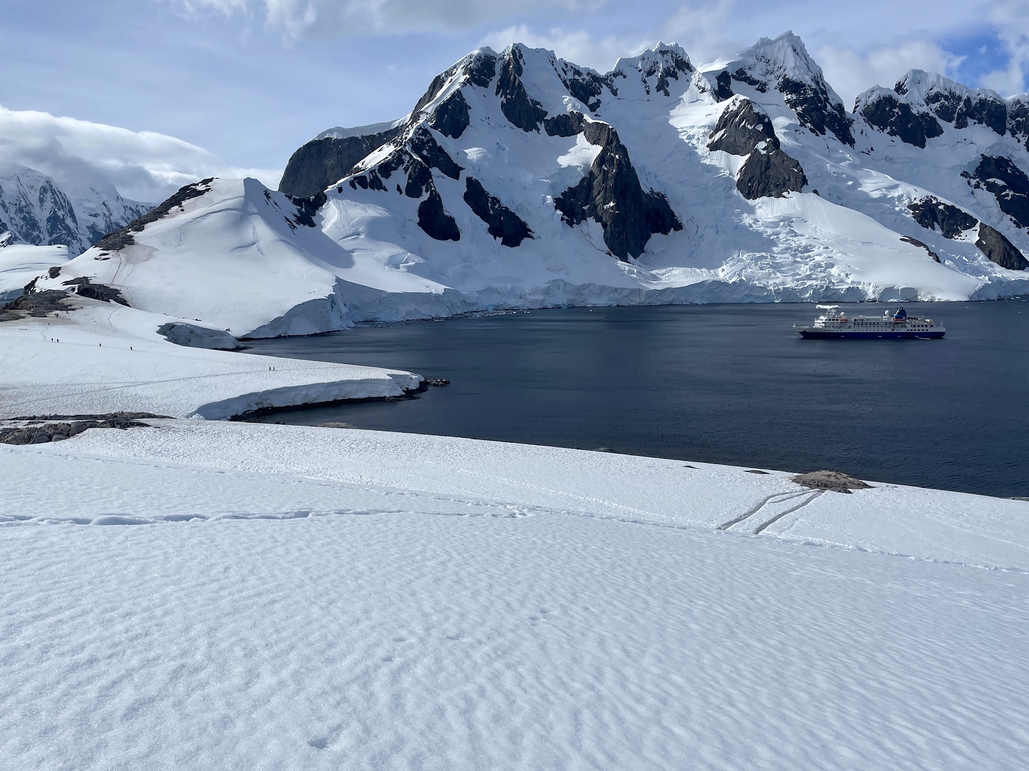
Before we went back to the zodiacs, this was the view of the ship in the bay next to Port Charcot – photo submitted for scale. The ship was small by 2024 large passenger ship standards, but it wasn’t exactly “small.”
Once the weather turned it got a lot more overcast and cold, which meant we got to see the ocean begin to freeze around us (this happens once ocean temperatures reach -1.8°C). We’ll spare you the full science lesson, but what you see in this video is what’s known as shuga ice starting to turn into “pancake ice,” where new ice is starting to form. It was pretty spellbinding to be tooling around in it on our zodiac.
This photo is not the same as new sea ice being formed; it’s what’s known as “brash ice,” which is little bits of ice that have been broken off larger pieces and begun to collect in an area due to the water currents, etc. When we were out on the zodiac one day (where it wasn’t quite as cold as the day the ocean was freezing, but still overcast) we suddenly found ourselves in a huge field of brash ice that hadn’t been there an hour earlier when the expedition team was prepping for our excursion. You can move through brash ice in the military-grade zodiacs we had, but only very slowly and carefully.
Before we crossed back over the Antarctic Circle and returned farther north, the sun came out and the wind slowed, so we stopped in the Buchanan Channel for a polar plunge! It was a bit disconcerting to see an AED sitting next to the mugs and carafe holding the hot chocolate and Bailey’s…luckily we didn’t need to use it but apparently it’s been used multiple times before. People jump into that 0° water and their bodies get quite a shock. They did require us all to be strapped into a harness before we jumped in, because apparently even if your heart keeps beating a lot of people’s brains just freeze a bit and they totally forget how to swim, or even that they need to swim. Anyway, it was “invigorating.” Really freaking cold. Really freaking salty. But really freaking fun. We earned the Bailey’s hot chocolate. Even Cole. 😜
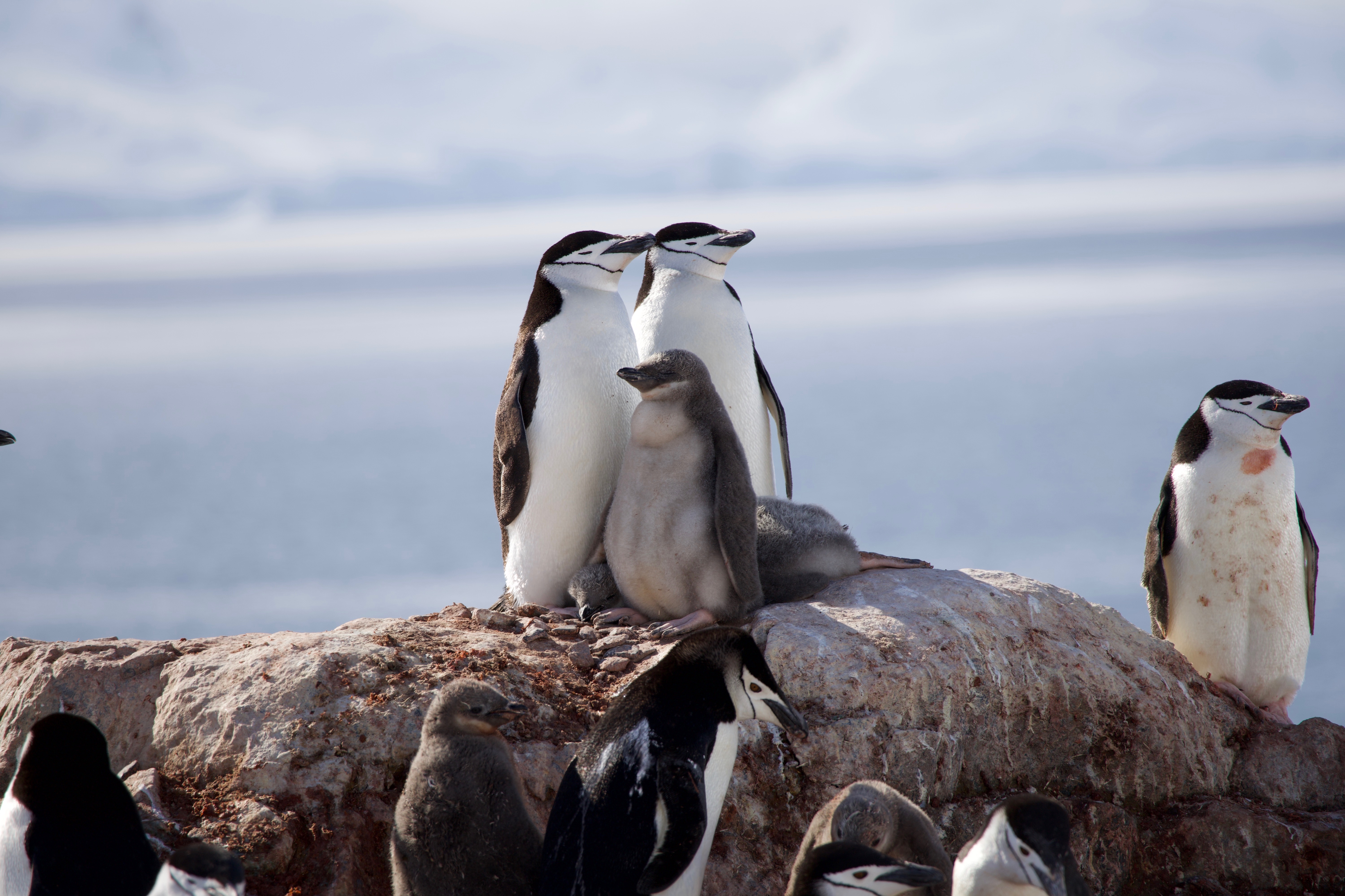
We’ve come to the end of the penguin pictures. (If you are craving more penguin pictures we probably have approximately 8,000 more pictures we can send you.) These lovelies are the aptly-named Chinstrap penguins. You can probably also guess that it was Cole who took this awesome photo of the parents with their fluffy chick (I’m pretty sure this was on Palaver Point, which had a huge Chinstrap rookery).
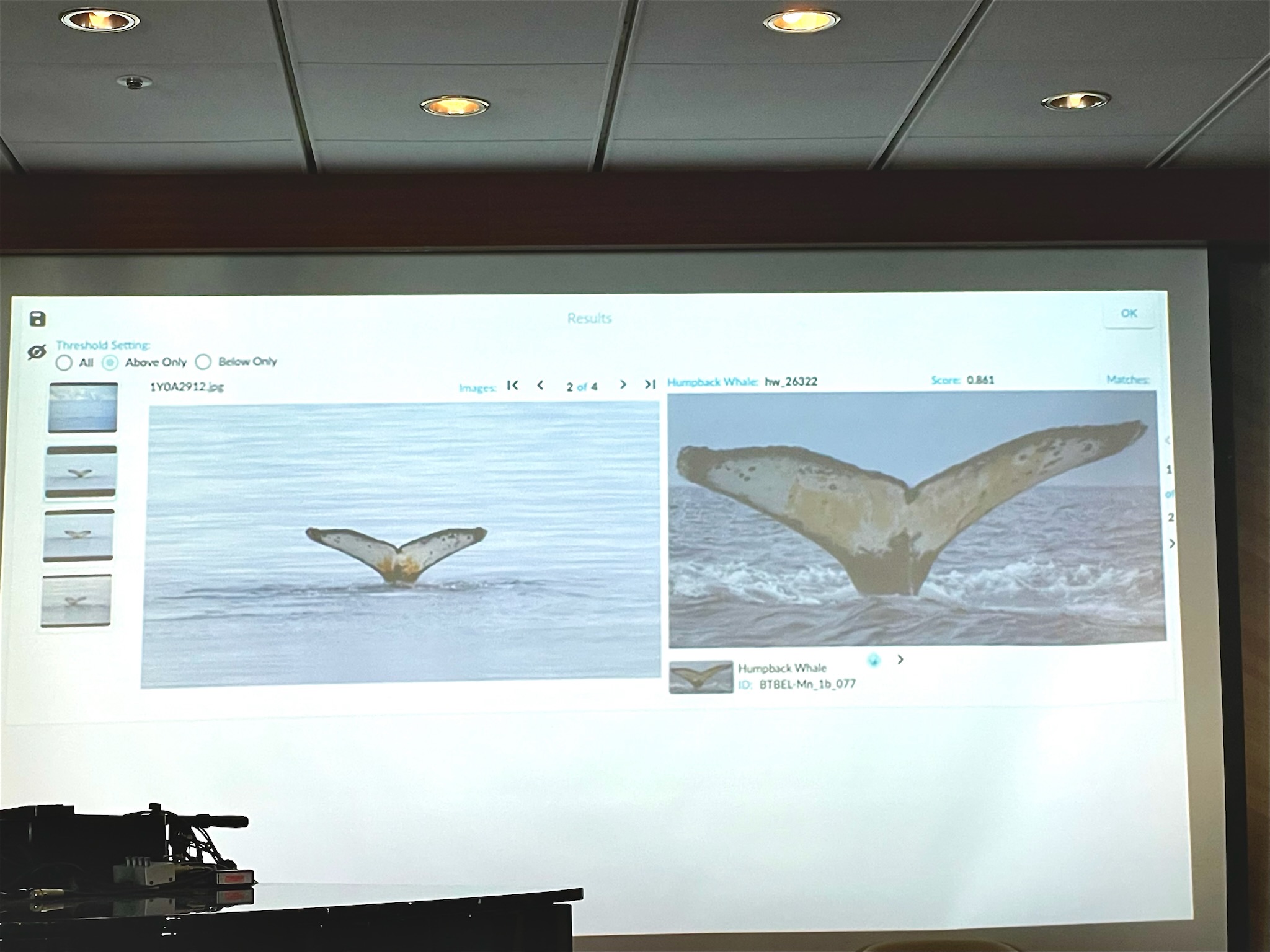
One other really cool thing on this trip was the partnership with HappyWhale, which is this amazing non-profit that tracks whales as they migrate around. Each whale species has some unique part of their body that is like a fingerprint – for Humpback whales it’s the underside of their tail (the fluke). If someone was able to get a clear photo of the fluke, then one of our expedition crew could upload it to HappyWhale to see if there was a hit – and in this case there was!! This whale, which we spotted on our voyage (photo on the left), was last seen in **Ecuador** in 2017 (photo on the right). If your jaw did not just hit the floor, you should go look at a map and look at how far away Ecuador is from the Antarctic peninsula. Holy moly our planet is amazing.
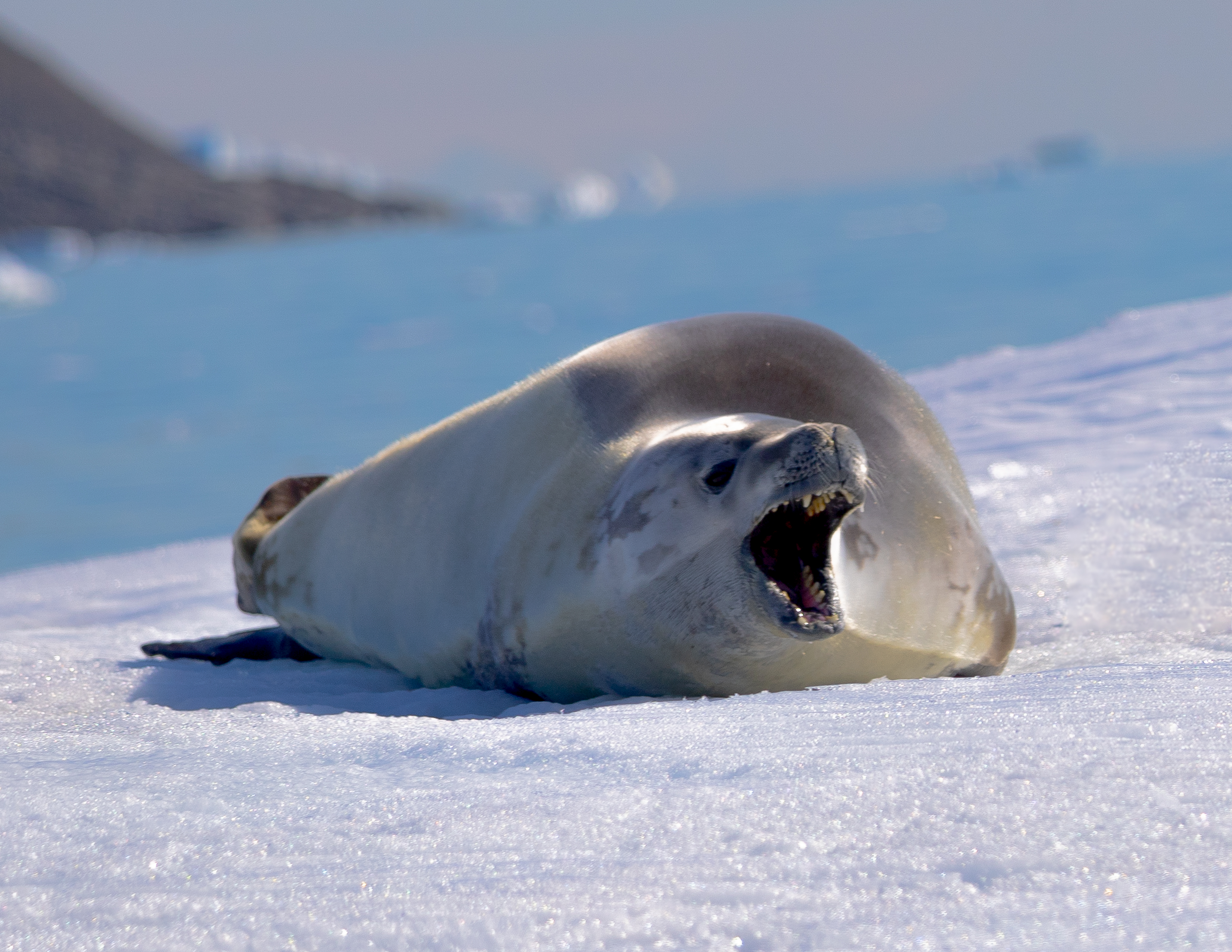
Here’s the last seal photo – this is an amazing shot Cole took of a crabeater seal yawning. It’s just expressing that it’s tired (or maybe that it’s mildly annoyed by this zodiac of humans interrupting his nap) not trying to be ferocious. But check out those teeth! And crabeaters aren’t even the vicious seals.
This is a kid who loves the snow. Hard to believe he was born in San Francisco. I see a lot more snow in his future.
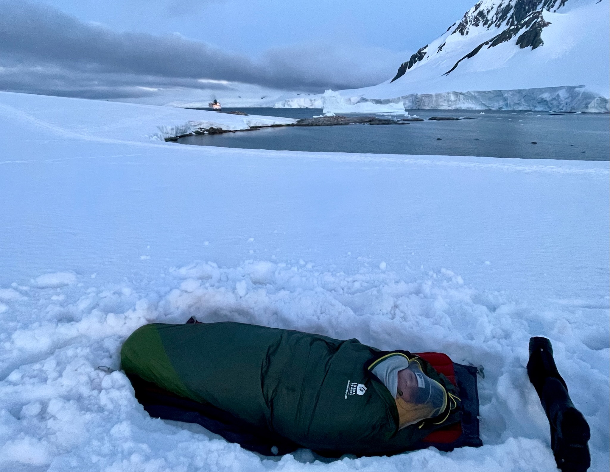
Speaking of snow, on our last night before heading back into the Drake Passage, the skies cleared and winds slowed enough for us to drag our gear onto the ice at Damoy Point so we could camp under the…well, maybe 5 stars, because it never really gets dark this far south in the summer. This photo isn’t color corrected; this is how dark it was at 11:30pm when we took it. And no, we didn’t have tents. We dug trenches in the frozen snow, laid down a nylon footprint, encased our hefty sleeping bags in waterproof bivy sacks, and climbed in for some dozing a little too close to a colony of noisy gentoo penguins for peaceful sleeping. The cold wasn’t actually the problem. But about 4am there was a wind alert, and we got a few 40 and 50-knot gusts. That was extremely cold and difficult to sleep through. They came to get us about 5:30am to bring us back for steaming coffee and hot showers in the shelter of our cabins.
There’s major concern right now about avian flu that is spreading on the continent, and can be fatal for penguins. We talked about it a lot, and had very strict requirements not to get within 5 meters of any penguins and not to let anything except our boots touch the snow or ground in areas inhabited by penguins. We had to go through a full biosecurity screening (with all of our outwear, backpacks, etc.) at the start of the voyage just in case, disinfected our boots before leaving the ship on every excursion, and went through a full disinfection procedure (what we affectionately called the “boot car wash”) after every outing, before being allowed back into the main parts of the ship. We definitely did our part to keep the penguins safe, and hope that all the other people exploring Antarctica have been taking it as seriously as we did!
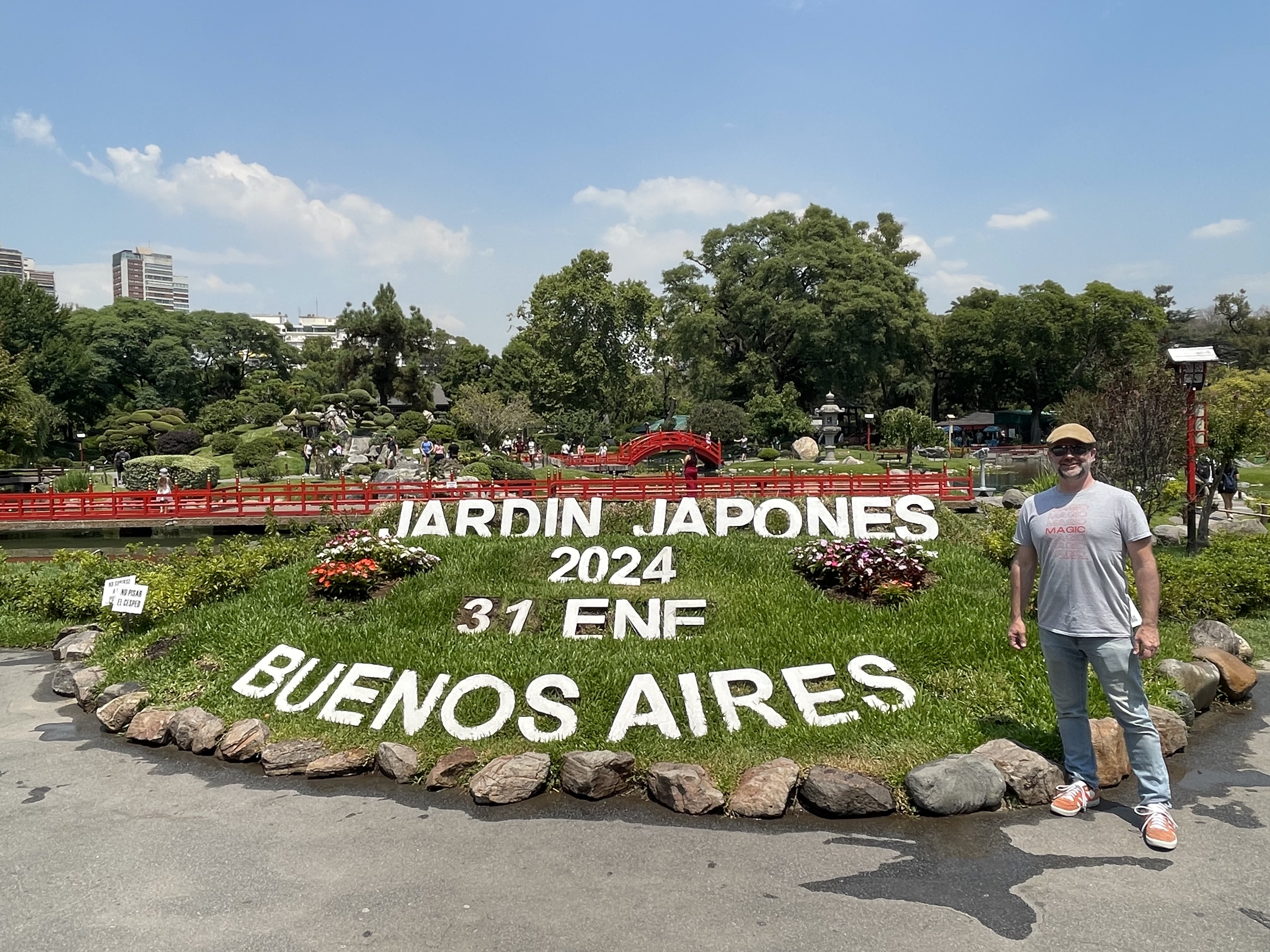
If you’ve made it this far in the album, we hope that you’ve enjoyed this taste of our incredible Antarctic adventure. We just can’t say enough about our experience with Polar Latitudes and the entire expedition team. On the way home we managed a 24-hour stopover in Buenos Aires, which was good because it was Brian’s 45th birthday! 🎂 So instead of muscling through 22 hours of flying plus airport time (who wants THAT as a birthday present?) we explored the Japanese Garden and some other Buenos Aires sights with his friend Alba. A great way to close out a life-changing trip! ❤️